Son geodata
Son (North Brabant) is a populated place; located in Netherlands in Europe/Amsterdam (GMT+2) time zone. With population of 4,930 people, there are 491 cities with bigger population in this country. Compared to other cities in Netherlands, 79.9% of cities are located further ↑North; 57% of cities are located further →East and 70.6% of cities have lower elevation than Son. Note1


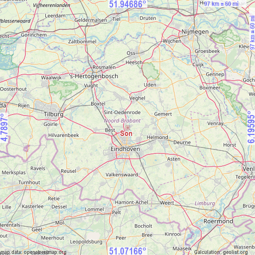
Son GPS coordinates[2]
51° 30' 40.896" North, 5° 29' 34.152" East
| Map corner | latitude | longitude |
|---|---|---|
| Upper-left | 51.94686°, | 4.7897° |
| Center: | 51.51136°, | 5.49282° |
| Lower-right: | 51.07166°, | 6.19595° |
| Map W x H: | 97.3×97.3 km | = 60.5×60.5mi |
| max Lat: | 53.48025° ⇑79.9% North |
| Son: | 51.51136° |
| min Lat: | ⇓20.1% South 50.76917° |
| min Long | Son | max Long |
| 3.38611° | 5.49282° | 7.16528° |
| W 43%⇐ | ⇒57% E |
Elevation
Elevation of Son is 15 m = 49 ft, and this is 0 m = 0 ft above average elevation for this country.
| Max E: |
203 m = 666 ft | 29.4% |
| Son | 15 m 49 ft | |
| Avg. | 15 m = 49 ft | |
Min E: |
-6 m = -20 ft | 70.6% |
See also: Netherlands elevation on elevation.city.
Geographical zone
Son is located in North temperate zone (between Tropic of Cancer and the Arctic Circle). Distance of this North polar circle is 1673.6 km =1039.9 mi to North.| Distance of | km | miles | from Son |
|---|---|---|---|
| North Pole | 4279.5 | 2659.2 | to North |
| Arctic Circle | 1673.6 | 1039.9 | to North |
| Tropic Cancer | 3121.6 | 1939.7 | to South |
| Equator | 5727.5 | 3558.9 | to South |


Nearby cities:
15 places around Son: (largest is in red/bold)
• Breugel
1.4 km =0.9 mi,  61°
61°
• Eckart
4.2 km =2.6 mi,  178°
178°
• Eerschot
6.5 km =4 mi,  348°
348°
• Gerwen
5.4 km =3.4 mi,  116°
116°
• Heesterakker
2.8 km =1.7 mi,  174°
174°
• Jagershoef
4.6 km =2.9 mi,  202°
202°
• Mariahout
6.4 km =4 mi, 59°
• Nederwetten
3.1 km =1.9 mi,  135°
135°
• Nijnsel
4.4 km =2.7 mi, 351°
• Nuenen
6.2 km =3.9 mi, 137°
• Son en Breugel
0.6 km =0.4 mi,  21°
21°
• Speelheide
6.1 km =3.8 mi,  264°
264°
• Vaartbroek
3.6 km =2.2 mi, 174°
• Vlokhoven
5 km =3.1 mi,  187°
187°
• Woenselse Heide
3.6 km =2.2 mi,  210°
210°
Sources, notices
• [Note1] Compared only with cities in Netherlands existing in our database
• [Src1] Map data: © OpenStreetMap contributors (CC-BY-SA)
• [Src2] Other city data from geonames.org with taken over terms of usage.
• [Src3] Geographical zone / Annual Mean Temperature by Robert A. Rohde @ Wikipedia
