Damwâld geodata
Damwâld (Friesland) is a populated place; located in Netherlands in Europe/Amsterdam (GMT+2) time zone. With population of 5,560 people, there are 436 cities with bigger population in this country. Compared to other cities in Netherlands, 97.1% of cities are located further ↓South; 72.7% of cities are located further ←West and 65.8% of cities have higher elevation than Damwâld. Note1


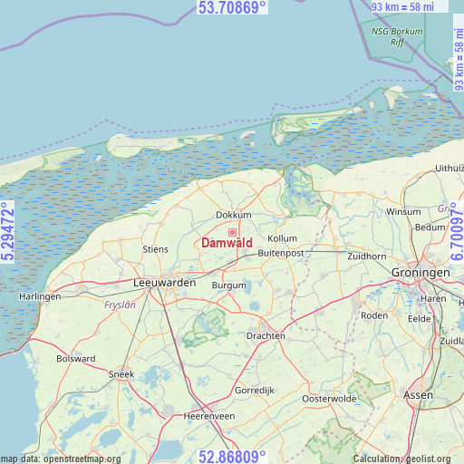
Damwâld GPS coordinates[2]
53° 17' 25.656" North, 5° 59' 52.26" East
| Map corner | latitude | longitude |
|---|---|---|
| Upper-left | 53.70869°, | 5.29472° |
| Center: | 53.29046°, | 5.99785° |
| Lower-right: | 52.86809°, | 6.70097° |
| Map W x H: | 93.5×93.5 km | = 58.1×58.1mi |
| max Lat: | 53.48025° ⇑2.9% North |
| Damwâld: | 53.29046° |
| min Lat: | ⇓97.1% South 50.76917° |
| min Long | Damwâld | max Long |
| 3.38611° | 5.99785° | 7.16528° |
| W 72.7%⇐ | ⇒27.3% E |
Elevation
Elevation of Damwâld is 3 m = 10 ft, and this is 12 m = 39 ft below average elevation for this country.
| Max E: |
203 m = 666 ft | 65.8% |
| Avg. | 15 m = 49 ft | |
| Damwâld | 3 m = 10 ft | |
Min E: |
-6 m = -20 ft | 34.2% |
See also: Netherlands elevation on elevation.city.
Geographical zone
Damwâld is located in North temperate zone (between Tropic of Cancer and the Arctic Circle). Distance of this North polar circle is 1475.8 km =917 mi to North.| Distance of | km | miles | from Damwâld |
|---|---|---|---|
| North Pole | 4081.7 | 2536.3 | to North |
| Arctic Circle | 1475.8 | 917 | to North |
| Tropic Cancer | 3319.4 | 2062.6 | to South |
| Equator | 5925.3 | 3681.8 | to South |


Nearby cities:
15 places around Damwâld: (largest is in red/bold)
• Aldtsjerk
7.8 km =4.8 mi,  250°
250°
• Broeksterwâld
1.8 km =1.1 mi,  182°
182°
• De Westereen
4.5 km =2.8 mi,  145°
145°
• Dokkum
3.5 km =2.2 mi,  359°
359°
• Driezum
3.3 km =2.1 mi,  79°
79°
• Feanwâlden
6.1 km =3.8 mi,  185°
185°
• Kollumerzwaag
6 km =3.7 mi,  121°
121°
• Mûnein
6.7 km =4.2 mi,  230°
230°
• Noardburgum
7.7 km =4.8 mi, 176°
• Oentsjerk
7.9 km =4.9 mi,  235°
235°
• Oudwoude
7.8 km =4.8 mi,  96°
96°
• Rinsumageast
3.3 km =2.1 mi,  282°
282°
• Twijzelerheide
6.4 km =4 mi, 150°
• Wâlterswâld
2.6 km =1.6 mi,  65°
65°
• Zwagerbosch
5.7 km =3.5 mi,  144°
144°
Sources, notices
• [Note1] Compared only with cities in Netherlands existing in our database
• [Src1] Map data: © OpenStreetMap contributors (CC-BY-SA)
• [Src2] Other city data from geonames.org with taken over terms of usage.
• [Src3] Geographical zone / Annual Mean Temperature by Robert A. Rohde @ Wikipedia
