Buren geodata
Buren (Friesland) is a populated place; located in Netherlands in Europe/Amsterdam (GMT+2) time zone. With population of 710 people, there are 1613 cities with bigger population in this country. Compared to other cities in Netherlands, 99.9% of cities are located further ↓South; 57.6% of cities are located further ←West and 58.8% of cities have higher elevation than Buren. Note1


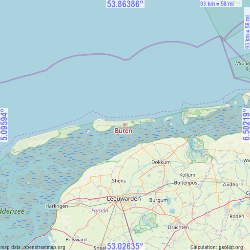
Buren GPS coordinates[2]
53° 26' 49.812" North, 5° 47' 56.616" East
| Map corner | latitude | longitude |
|---|---|---|
| Upper-left | 53.86386°, | 5.09594° |
| Center: | 53.44717°, | 5.79906° |
| Lower-right: | 53.02635°, | 6.50219° |
| Map W x H: | 93.1×93.1 km | = 57.8×57.8mi |
| max Lat: | 53.48025° ⇑0.1% North |
| Buren: | 53.44717° |
| min Lat: | ⇓99.9% South 50.76917° |
| min Long | Buren | max Long |
| 3.38611° | 5.79906° | 7.16528° |
| W 57.6%⇐ | ⇒42.4% E |
Elevation
Elevation of Buren is 4 m = 13 ft, and this is 11 m = 36 ft below average elevation for this country.
| Max E: |
203 m = 666 ft | 58.8% |
| Avg. | 15 m = 49 ft | |
| Buren | 4 m = 13 ft | |
Min E: |
-6 m = -20 ft | 41.2% |
See also: Netherlands elevation on elevation.city.
Geographical zone
Buren is located in North temperate zone (between Tropic of Cancer and the Arctic Circle). Distance of this North polar circle is 1458.4 km =906.2 mi to North.| Distance of | km | miles | from Buren |
|---|---|---|---|
| North Pole | 4064.3 | 2525.4 | to North |
| Arctic Circle | 1458.4 | 906.2 | to North |
| Tropic Cancer | 3336.8 | 2073.4 | to South |
| Equator | 5942.8 | 3692.7 | to South |


Nearby cities:
15 places around Buren: (largest is in red/bold)
• Blije
11.4 km =7.1 mi,  158°
158°
• Burdaard
17.8 km =11.1 mi, 162°
• Dokkum
19.1 km =11.9 mi,  136°
136°
• Ferwert
12.3 km =7.6 mi,  171°
171°
• Hallum
15.7 km =9.8 mi,  183°
183°
• Hollum
10.7 km =6.6 mi,  265°
265°
• Holwerd
11.1 km =6.9 mi, 142°
• Marrum
13.8 km =8.6 mi, 179°
• Metslawier
20.2 km =12.6 mi,  118°
118°
• Nes
1.7 km =1.1 mi,  261°
261°
• Oosternijkerk
18.5 km =11.5 mi,  114°
114°
• Oude Bildtzijl
17.2 km =10.7 mi,  198°
198°
• Rinsumageast
19.5 km =12.1 mi,  149°
149°
• Ternaard
13.2 km =8.2 mi, 123°
• Vrouwenparochie
19.8 km =12.3 mi, 199°
Sources, notices
• [Note1] Compared only with cities in Netherlands existing in our database
• [Src1] Map data: © OpenStreetMap contributors (CC-BY-SA)
• [Src2] Other city data from geonames.org with taken over terms of usage.
• [Src3] Geographical zone / Annual Mean Temperature by Robert A. Rohde @ Wikipedia
