Hollum geodata
Hollum (Friesland) is a populated place; located in Netherlands in Europe/Amsterdam (GMT+2) time zone. With population of 1,160 people, there are 1302 cities with bigger population in this country. Compared to other cities in Netherlands, 99.8% of cities are located further ↓South; 50.6% of cities are located further →East and 65.8% of cities have higher elevation than Hollum. Note1


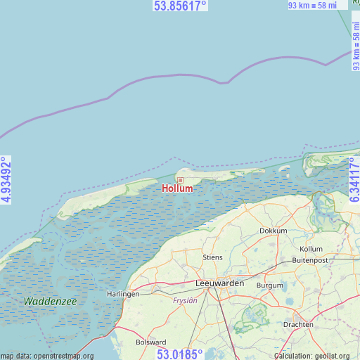
Hollum GPS coordinates[2]
53° 26' 21.84" North, 5° 38' 16.98" East
| Map corner | latitude | longitude |
|---|---|---|
| Upper-left | 53.85617°, | 4.93492° |
| Center: | 53.4394°, | 5.63805° |
| Lower-right: | 53.0185°, | 6.34117° |
| Map W x H: | 93.1×93.1 km | = 57.8×57.8mi |
| max Lat: | 53.48025° ⇑0.2% North |
| Hollum: | 53.4394° |
| min Lat: | ⇓99.8% South 50.76917° |
| min Long | Hollum | max Long |
| 3.38611° | 5.63805° | 7.16528° |
| W 49.4%⇐ | ⇒50.6% E |
Elevation
Elevation of Hollum is 3 m = 10 ft, and this is 12 m = 39 ft below average elevation for this country.
| Max E: |
203 m = 666 ft | 65.8% |
| Avg. | 15 m = 49 ft | |
| Hollum | 3 m = 10 ft | |
Min E: |
-6 m = -20 ft | 34.2% |
See also: Netherlands elevation on elevation.city.
Geographical zone
Hollum is located in North temperate zone (between Tropic of Cancer and the Arctic Circle). Distance of this North polar circle is 1459.3 km =906.8 mi to North.| Distance of | km | miles | from Hollum |
|---|---|---|---|
| North Pole | 4065.2 | 2526 | to North |
| Arctic Circle | 1459.3 | 906.8 | to North |
| Tropic Cancer | 3336 | 2072.9 | to South |
| Equator | 5941.9 | 3692.1 | to South |


Nearby cities:
15 places around Hollum: (largest is in red/bold)
• Berltsum
21.8 km =13.5 mi,  177°
177°
• Blije
17.7 km =11 mi,  123°
123°
• Buren
10.7 km =6.6 mi,  85°
85°
• Ferwert
16.8 km =10.4 mi,  132°
132°
• Hallum
17.7 km =11 mi,  146°
146°
• Holwerd
19.1 km =11.9 mi,  114°
114°
• Marrum
16.9 km =10.5 mi,  140°
140°
• Minnertsga
21.1 km =13.1 mi,  187°
187°
• Nes
9 km =5.6 mi, 86°
• Oude Bildtzijl
16.3 km =10.1 mi,  160°
160°
• Sint Annaparochie
18.2 km =11.3 mi, 175°
• Sint Jacobiparochie
18.7 km =11.6 mi, 187°
• Stiens
21.2 km =13.2 mi, 158°
• Ternaard
22.6 km =14 mi, 106°
• Vrouwenparochie
18.3 km =11.4 mi,  166°
166°
Sources, notices
• [Note1] Compared only with cities in Netherlands existing in our database
• [Src1] Map data: © OpenStreetMap contributors (CC-BY-SA)
• [Src2] Other city data from geonames.org with taken over terms of usage.
• [Src3] Geographical zone / Annual Mean Temperature by Robert A. Rohde @ Wikipedia
