Breezand geodata
Breezand (North Holland) is a populated place; located in Netherlands in Europe/Amsterdam (GMT+2) time zone. With population of 3,370 people, there are 701 cities with bigger population in this country. Compared to other cities in Netherlands, 82.4% of cities are located further ↓South; 79.5% of cities are located further →East and 96.1% of cities have higher elevation than Breezand. Note1


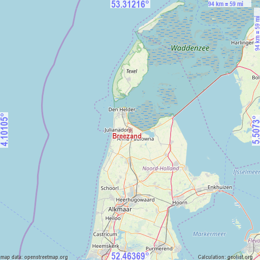
Breezand GPS coordinates[2]
52° 53' 24" North, 4° 48' 15.012" East
| Map corner | latitude | longitude |
|---|---|---|
| Upper-left | 53.31216°, | 4.10105° |
| Center: | 52.89°, | 4.80417° |
| Lower-right: | 52.46369°, | 5.5073° |
| Map W x H: | 94.3×94.3 km | = 58.6×58.6mi |
| max Lat: | 53.48025° ⇑17.6% North |
| Breezand: | 52.89° |
| min Lat: | ⇓82.4% South 50.76917° |
| min Long | Breezand | max Long |
| 3.38611° | 4.80417° | 7.16528° |
| W 20.5%⇐ | ⇒79.5% E |
Elevation
Elevation of Breezand is -1 m = -3 ft, and this is 16 m = 52 ft below average elevation for this country.
| Max E: |
203 m = 666 ft | 96.1% |
| Avg. | 15 m = 49 ft | |
| Breezand | -1 m = -3 ft | |
Min E: |
-6 m = -20 ft | 3.9% |
See also: Netherlands elevation on elevation.city.
Geographical zone
Breezand is located in North temperate zone (between Tropic of Cancer and the Arctic Circle). Distance of this North polar circle is 1520.4 km =944.7 mi to North.| Distance of | km | miles | from Breezand |
|---|---|---|---|
| North Pole | 4126.2 | 2563.9 | to North |
| Arctic Circle | 1520.4 | 944.7 | to North |
| Tropic Cancer | 3274.9 | 2034.9 | to South |
| Equator | 5880.8 | 3654.2 | to South |


Nearby cities:
15 places around Breezand: (largest is in red/bold)
• 't Zand
6.8 km =4.2 mi,  208°
208°
• Barsingerhorn
12.3 km =7.6 mi,  161°
161°
• Callantsoog
9.2 km =5.7 mi,  232°
232°
• Den Helder
8.3 km =5.2 mi,  338°
338°
• Hippolytushoef
10.8 km =6.7 mi,  79°
79°
• Kolhorn
12.1 km =7.5 mi,  151°
151°
• Oudesluis
6.2 km =3.9 mi,  177°
177°
• Schagen
11.4 km =7.1 mi, 181°
• Schagerbrug
10.2 km =6.3 mi,  197°
197°
• Sint Maarten
13.6 km =8.5 mi, 196°
• Sint Maartensbrug
13.2 km =8.2 mi, 202°
• Sint Maartensvlotbrug
13.2 km =8.2 mi, 209°
• Slootdorp
12.5 km =7.8 mi,  115°
115°
• Westerland
8.4 km =5.2 mi,  86°
86°
• Wieringerwaard
7.3 km =4.5 mi, 145°
Sources, notices
• [Note1] Compared only with cities in Netherlands existing in our database
• [Src1] Map data: © OpenStreetMap contributors (CC-BY-SA)
• [Src2] Other city data from geonames.org with taken over terms of usage.
• [Src3] Geographical zone / Annual Mean Temperature by Robert A. Rohde @ Wikipedia
