Sint Maartensvlotbrug geodata
Sint Maartensvlotbrug (North Holland) is a populated place; located in Netherlands in Europe/Amsterdam (GMT+2) time zone. With population of 715 people, there are 1609 cities with bigger population in this country. Compared to other cities in Netherlands, 79.4% of cities are located further ↓South; 82.8% of cities are located further →East and 83.9% of cities have higher elevation than Sint Maartensvlotbrug. Note1
Current local time in Sint Maartensvlotbrug:
07:59 AM, ThursdayDifference from your time zone: hours


Sint Maartensvlotbrug GPS coordinates[2]
52° 47' 12.012" North, 4° 42' 29.988" East
| Map corner | latitude | longitude |
|---|---|---|
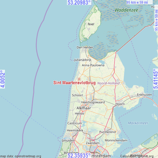
| Upper-left | 53.20983°, | 4.0052° |
| Center: | 52.78667°, | 4.70833° |
| Lower-right: | 52.35935°, | 5.41145° |
| Map W x H: | 94.6×94.6 km | = 58.8×58.8mi |
| max Lat: | 53.48025° ⇑20.6% North |
| Sint Maartensvlotbrug: | 52.78667° |
| min Lat: | ⇓79.4% South 50.76917° |
| min Long | Sint Maartensvl | max Long |
| 3.38611° | 4.70833° | 7.16528° |
| W 17.2%⇐ | ⇒82.8% E |
Elevation
Elevation of Sint Maartensvlotbrug is 1 m = 3 ft, and this is 14 m = 46 ft below average elevation for this country.
| Max E: |
203 m = 666 ft | 83.9% |
| Avg. | 15 m = 49 ft | |
| Sint Maartensvlotbrug | 1 m = 3 ft | |
Min E: |
-6 m = -20 ft | 16.1% |
See also: Netherlands elevation on elevation.city.
Geographical zone
Sint Maartensvlotbrug is located in North temperate zone (between Tropic of Cancer and the Arctic Circle). Distance of this North polar circle is 1531.8 km =951.8 mi to North.| Distance of | km | miles | from Sint Maartensvlotbrug |
|---|---|---|---|
| North Pole | 4137.7 | 2571 | to North |
| Arctic Circle | 1531.8 | 951.8 | to North |
| Tropic Cancer | 3263.4 | 2027.8 | to South |
| Equator | 5869.3 | 3647 | to South |


Nearby cities:
15 places around Sint Maartensvlotbrug: (largest is in red/bold)
• 't Zand
6.4 km =4 mi,  29°
29°
• Aagtdorp
10.8 km =6.7 mi,  181°
181°
• Barsingerhorn
10.5 km =6.5 mi,  91°
91°
• Burgerbrug
4.3 km =2.7 mi,  185°
185°
• Callantsoog
6 km =3.7 mi,  351°
351°
• Dirkshorn
6.1 km =3.8 mi,  132°
132°
• Harenkarspel
7.4 km =4.6 mi,  141°
141°
• Oudesluis
8.5 km =5.3 mi,  51°
51°
• Oudkarspel
10.2 km =6.3 mi, 140°
• Petten
3.9 km =2.4 mi,  235°
235°
• Schagen
6.1 km =3.8 mi, 89°
• Schagerbrug
3.8 km =2.4 mi,  62°
62°
• Sint Maarten
3 km =1.9 mi,  121°
121°
• Sint Maartensbrug
1.5 km =0.9 mi, 116°
• Waarland
10.7 km =6.6 mi, 128°
Sources, notices
• [Note1] Compared only with cities in Netherlands existing in our database
• [Src1] Map data: © OpenStreetMap contributors (CC-BY-SA)
• [Src2] Other city data from geonames.org with taken over terms of usage.
• [Src3] Geographical zone / Annual Mean Temperature by Robert A. Rohde @ Wikipedia
