Wieringerwaard geodata
Wieringerwaard (North Holland) is a populated place; located in Netherlands in Europe/Amsterdam (GMT+2) time zone. With population of 1,795 people, there are 1019 cities with bigger population in this country. Compared to other cities in Netherlands, 80.7% of cities are located further ↓South; 77.3% of cities are located further →East and 96.1% of cities have higher elevation than Wieringerwaard. Note1


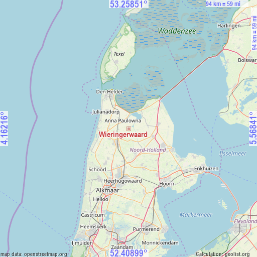
Wieringerwaard GPS coordinates[2]
52° 50' 8.988" North, 4° 51' 55.008" East
| Map corner | latitude | longitude |
|---|---|---|
| Upper-left | 53.25851°, | 4.16216° |
| Center: | 52.83583°, | 4.86528° |
| Lower-right: | 52.40899°, | 5.56841° |
| Map W x H: | 94.5×94.5 km | = 58.7×58.7mi |
| max Lat: | 53.48025° ⇑19.3% North |
| Wieringerwaard: | 52.83583° |
| min Lat: | ⇓80.7% South 50.76917° |
| min Long | Wieringerwaard | max Long |
| 3.38611° | 4.86528° | 7.16528° |
| W 22.7%⇐ | ⇒77.3% E |
Elevation
Elevation of Wieringerwaard is -1 m = -3 ft, and this is 16 m = 52 ft below average elevation for this country.
| Max E: |
203 m = 666 ft | 96.1% |
| Avg. | 15 m = 49 ft | |
| Wieringerwaard | -1 m = -3 ft | |
Min E: |
-6 m = -20 ft | 3.9% |
See also: Netherlands elevation on elevation.city.
Geographical zone
Wieringerwaard is located in North temperate zone (between Tropic of Cancer and the Arctic Circle). Distance of this North polar circle is 1526.4 km =948.5 mi to North.| Distance of | km | miles | from Wieringerwaard |
|---|---|---|---|
| North Pole | 4132.3 | 2567.7 | to North |
| Arctic Circle | 1526.4 | 948.5 | to North |
| Tropic Cancer | 3268.9 | 2031.2 | to South |
| Equator | 5874.8 | 3650.4 | to South |


Nearby cities:
15 places around Wieringerwaard: (largest is in red/bold)
• 't Zand
7.4 km =4.6 mi,  270°
270°
• Barsingerhorn
5.7 km =3.5 mi,  180°
180°
• Breezand
7.3 km =4.5 mi,  325°
325°
• Hippolytushoef
10.3 km =6.4 mi,  39°
39°
• Kolhorn
4.9 km =3 mi,  161°
161°
• Middenmeer
9.5 km =5.9 mi,  109°
109°
• Nieuwe-Niedorp
10.9 km =6.8 mi,  168°
168°
• Oudesluis
3.8 km =2.4 mi, 267°
• Schagen
7 km =4.3 mi,  219°
219°
• Schagerbrug
8.1 km =5 mi,  242°
242°
• Sint Maarten
10.7 km =6.6 mi,  228°
228°
• Slootdorp
7.2 km =4.5 mi,  84°
84°
• Westerland
7.8 km =4.8 mi,  33°
33°
• Wieringerwerf
10.9 km =6.8 mi, 81°
• Winkel
9.4 km =5.8 mi, 164°
Sources, notices
• [Note1] Compared only with cities in Netherlands existing in our database
• [Src1] Map data: © OpenStreetMap contributors (CC-BY-SA)
• [Src2] Other city data from geonames.org with taken over terms of usage.
• [Src3] Geographical zone / Annual Mean Temperature by Robert A. Rohde @ Wikipedia
