Hippolytushoef geodata
Hippolytushoef (North Holland) is a populated place; located in Netherlands in Europe/Amsterdam (GMT+2) time zone. With population of 4,800 people, there are 503 cities with bigger population in this country. Compared to other cities in Netherlands, 82.8% of cities are located further ↓South; 74.4% of cities are located further →East and 54.1% of cities have higher elevation than Hippolytushoef. Note1


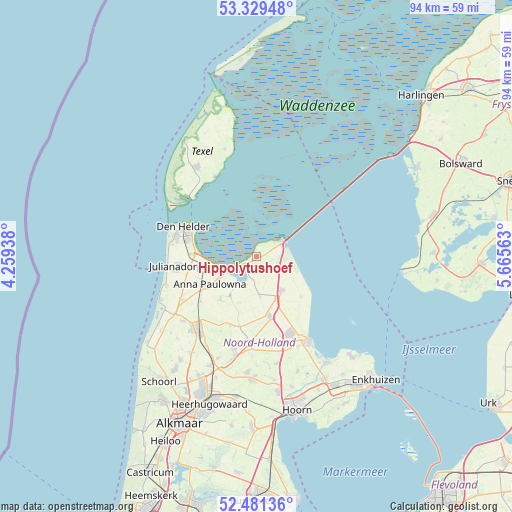
Hippolytushoef GPS coordinates[2]
52° 54' 27" North, 4° 57' 45" East
| Map corner | latitude | longitude |
|---|---|---|
| Upper-left | 53.32948°, | 4.25938° |
| Center: | 52.9075°, | 4.9625° |
| Lower-right: | 52.48136°, | 5.66563° |
| Map W x H: | 94.3×94.3 km | = 58.6×58.6mi |
| max Lat: | 53.48025° ⇑17.2% North |
| Hippolytushoef: | 52.9075° |
| min Lat: | ⇓82.8% South 50.76917° |
| min Long | Hippolytushoef | max Long |
| 3.38611° | 4.9625° | 7.16528° |
| W 25.6%⇐ | ⇒74.4% E |
Elevation
Elevation of Hippolytushoef is 5 m = 16 ft, and this is 10 m = 33 ft below average elevation for this country.
| Max E: |
203 m = 666 ft | 54.1% |
| Avg. | 15 m = 49 ft | |
| Hippolytushoef | 5 m = 16 ft | |
Min E: |
-6 m = -20 ft | 45.9% |
See also: Netherlands elevation on elevation.city.
Geographical zone
Hippolytushoef is located in North temperate zone (between Tropic of Cancer and the Arctic Circle). Distance of this North polar circle is 1518.4 km =943.5 mi to North.| Distance of | km | miles | from Hippolytushoef |
|---|---|---|---|
| North Pole | 4124.3 | 2562.7 | to North |
| Arctic Circle | 1518.4 | 943.5 | to North |
| Tropic Cancer | 3276.8 | 2036.1 | to South |
| Equator | 5882.8 | 3655.4 | to South |


Nearby cities:
15 places around Hippolytushoef: (largest is in red/bold)
• 't Zand
16 km =9.9 mi,  240°
240°
• Barsingerhorn
15.1 km =9.4 mi,  205°
205°
• Breezand
10.8 km =6.7 mi,  259°
259°
• Den Helder
14.8 km =9.2 mi,  293°
293°
• Den Oever
5.4 km =3.4 mi,  57°
57°
• Kolhorn
13.5 km =8.4 mi,  201°
201°
• Kreileroord
10.9 km =6.8 mi,  132°
132°
• Middenmeer
11.5 km =7.1 mi,  167°
167°
• Oudeschild
16.6 km =10.3 mi,  332°
332°
• Oudesluis
13.2 km =8.2 mi,  231°
231°
• Schagen
17.3 km =10.7 mi,  219°
219°
• Slootdorp
7.3 km =4.5 mi, 174°
• Westerland
2.7 km =1.7 mi, 236°
• Wieringerwaard
10.3 km =6.4 mi, 219°
• Wieringerwerf
7.6 km =4.7 mi,  145°
145°
Sources, notices
• [Note1] Compared only with cities in Netherlands existing in our database
• [Src1] Map data: © OpenStreetMap contributors (CC-BY-SA)
• [Src2] Other city data from geonames.org with taken over terms of usage.
• [Src3] Geographical zone / Annual Mean Temperature by Robert A. Rohde @ Wikipedia
