Aarle-Rixtel geodata
Aarle-Rixtel (North Brabant) is a populated place; located in Netherlands in Europe/Amsterdam (GMT+2) time zone. With population of 5,125 people, there are 472 cities with bigger population in this country. Compared to other cities in Netherlands, 80% of cities are located further ↑North; 50.5% of cities are located further →East and 77.1% of cities have lower elevation than Aarle-Rixtel. Note1


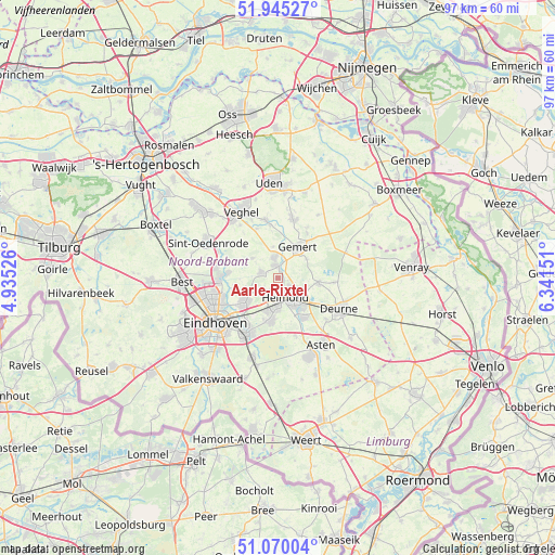
Aarle-Rixtel GPS coordinates[2]
51° 30' 35.136" North, 5° 38' 18.204" East
| Map corner | latitude | longitude |
|---|---|---|
| Upper-left | 51.94527°, | 4.93526° |
| Center: | 51.50976°, | 5.63839° |
| Lower-right: | 51.07004°, | 6.34151° |
| Map W x H: | 97.3×97.3 km | = 60.5×60.5mi |
| max Lat: | 53.48025° ⇑80% North |
| Aarle-Rixtel: | 51.50976° |
| min Lat: | ⇓20% South 50.76917° |
| min Long | Aarle-Rixtel | max Long |
| 3.38611° | 5.63839° | 7.16528° |
| W 49.5%⇐ | ⇒50.5% E |
Elevation
Elevation of Aarle-Rixtel is 19 m = 62 ft, and this is 4 m = 13 ft above average elevation for this country.
| Max E: |
203 m = 666 ft | 22.9% |
| Aarle-Rixtel | 19 m 62 ft | |
| Avg. | 15 m = 49 ft | |
Min E: |
-6 m = -20 ft | 77.1% |
See also: Netherlands elevation on elevation.city.
Geographical zone
Aarle-Rixtel is located in North temperate zone (between Tropic of Cancer and the Arctic Circle). Distance of this North polar circle is 1673.8 km =1040.1 mi to North.| Distance of | km | miles | from Aarle-Rixtel |
|---|---|---|---|
| North Pole | 4279.7 | 2659.3 | to North |
| Arctic Circle | 1673.8 | 1040.1 | to North |
| Tropic Cancer | 3121.4 | 1939.5 | to South |
| Equator | 5727.3 | 3558.8 | to South |


Nearby cities:
15 places around Aarle-Rixtel: (largest is in red/bold)
• Bakel
7.1 km =4.4 mi,  95°
95°
• Beek
2.2 km =1.4 mi,  351°
351°
• Boerdonk
5.6 km =3.5 mi, 350°
• Brand
5.8 km =3.6 mi,  189°
189°
• De Mortel
5.9 km =3.7 mi,  55°
55°
• Donk
3.3 km =2.1 mi, 348°
• Doonheide
7.4 km =4.6 mi,  31°
31°
• Gemert
6.3 km =3.9 mi,  35°
35°
• Gerwen
5.7 km =3.5 mi,  247°
247°
• Helmond
3.5 km =2.2 mi,  153°
153°
• Lieshout
3.2 km =2 mi,  291°
291°
• Mariahout
5.7 km =3.5 mi,  307°
307°
• Nuenen
7.4 km =4.6 mi,  233°
233°
• Schutsboom
5.5 km =3.4 mi, 191°
• Stepekolk
6.3 km =3.9 mi,  196°
196°
Sources, notices
• [Note1] Compared only with cities in Netherlands existing in our database
• [Src1] Map data: © OpenStreetMap contributors (CC-BY-SA)
• [Src2] Other city data from geonames.org with taken over terms of usage.
• [Src3] Geographical zone / Annual Mean Temperature by Robert A. Rohde @ Wikipedia
