Beuningen geodata
Beuningen (Gelderland) is a populated place; located in Netherlands in Europe/Amsterdam (GMT+2) time zone. With population of 25,557 people, there are 129 cities with bigger population in this country. Compared to other cities in Netherlands, 60.7% of cities are located further ↑North; 55.4% of cities are located further ←West and 59.4% of cities have lower elevation than Beuningen. Note1


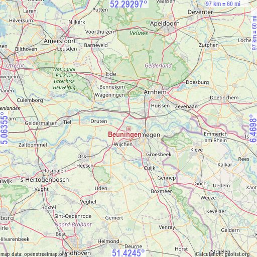
Beuningen GPS coordinates[2]
51° 51' 38.988" North, 5° 46' 0.012" East
| Map corner | latitude | longitude |
|---|---|---|
| Upper-left | 52.29297°, | 5.06355° |
| Center: | 51.86083°, | 5.76667° |
| Lower-right: | 51.4245°, | 6.4698° |
| Map W x H: | 96.6×96.6 km | = 60×60mi |
| max Lat: | 53.48025° ⇑60.7% North |
| Beuningen: | 51.86083° |
| min Lat: | ⇓39.3% South 50.76917° |
| min Long | Beuningen | max Long |
| 3.38611° | 5.76667° | 7.16528° |
| W 55.4%⇐ | ⇒44.6% E |
Elevation
Elevation of Beuningen is 10 m = 33 ft, and this is 5 m = 16 ft below average elevation for this country.
| Max E: |
203 m = 666 ft | 40.6% |
| Avg. | 15 m = 49 ft | |
| Beuningen | 10 m = 33 ft | |
Min E: |
-6 m = -20 ft | 59.4% |
See also: Netherlands elevation on elevation.city.
Geographical zone
Beuningen is located in North temperate zone (between Tropic of Cancer and the Arctic Circle). Distance of this North polar circle is 1634.8 km =1015.8 mi to North.| Distance of | km | miles | from Beuningen |
|---|---|---|---|
| North Pole | 4240.7 | 2635 | to North |
| Arctic Circle | 1634.8 | 1015.8 | to North |
| Tropic Cancer | 3160.5 | 1963.8 | to South |
| Equator | 5766.4 | 3583.1 | to South |


Nearby cities:
15 places around Beuningen: (largest is in red/bold)
• Alverna
6.3 km =3.9 mi,  184°
184°
• Andelst
5.9 km =3.7 mi,  334°
334°
• Bergharen
6.8 km =4.2 mi,  260°
260°
• Deest
7.6 km =4.7 mi,  295°
295°
• Hatert
7.5 km =4.7 mi,  144°
144°
• Hees
4.8 km =3 mi,  117°
117°
• Hernen
6.6 km =4.1 mi,  243°
243°
• Hunnerberg
8 km =5 mi,  105°
105°
• Lent
6.9 km =4.3 mi,  89°
89°
• Lindenholt
3.6 km =2.2 mi,  149°
149°
• Nijmegen
6.3 km =3.9 mi, 109°
• Oosterhout
4.6 km =2.9 mi,  62°
62°
• Valburg
5.9 km =3.7 mi,  15°
15°
• Valendries
6.4 km =4 mi,  200°
200°
• Wijchen
6.4 km =4 mi,  206°
206°
Sources, notices
• [Note1] Compared only with cities in Netherlands existing in our database
• [Src1] Map data: © OpenStreetMap contributors (CC-BY-SA)
• [Src2] Other city data from geonames.org with taken over terms of usage.
• [Src3] Geographical zone / Annual Mean Temperature by Robert A. Rohde @ Wikipedia
