Wijchen geodata
Wijchen (Gelderland) is a populated place; located in Netherlands in Europe/Amsterdam (GMT+2) time zone. With population of 32,693 people, there are 99 cities with bigger population in this country. Compared to other cities in Netherlands, 64.2% of cities are located further ↑North; 53.2% of cities are located further ←West and 59.4% of cities have lower elevation than Wijchen. Note1


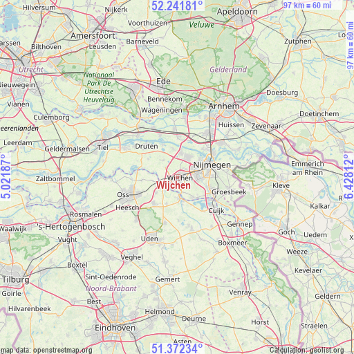
Wijchen GPS coordinates[2]
51° 48' 33.012" North, 5° 43' 30" East
| Map corner | latitude | longitude |
|---|---|---|
| Upper-left | 52.24181°, | 5.02187° |
| Center: | 51.80917°, | 5.725° |
| Lower-right: | 51.37234°, | 6.42812° |
| Map W x H: | 96.7×96.7 km | = 60.1×60.1mi |
| max Lat: | 53.48025° ⇑64.2% North |
| Wijchen: | 51.80917° |
| min Lat: | ⇓35.8% South 50.76917° |
| min Long | Wijchen | max Long |
| 3.38611° | 5.725° | 7.16528° |
| W 53.2%⇐ | ⇒46.8% E |
Elevation
Elevation of Wijchen is 10 m = 33 ft, and this is 5 m = 16 ft below average elevation for this country.
| Max E: |
203 m = 666 ft | 40.6% |
| Avg. | 15 m = 49 ft | |
| Wijchen | 10 m = 33 ft | |
Min E: |
-6 m = -20 ft | 59.4% |
See also: Netherlands elevation on elevation.city.
Geographical zone
Wijchen is located in North temperate zone (between Tropic of Cancer and the Arctic Circle). Distance of this North polar circle is 1640.5 km =1019.4 mi to North.| Distance of | km | miles | from Wijchen |
|---|---|---|---|
| North Pole | 4246.4 | 2638.6 | to North |
| Arctic Circle | 1640.5 | 1019.4 | to North |
| Tropic Cancer | 3154.7 | 1960.2 | to South |
| Equator | 5760.6 | 3579.5 | to South |


Nearby cities:
15 places around Wijchen: (largest is in red/bold)
• Alverna
2.5 km =1.6 mi,  103°
103°
• Batenburg
6.8 km =4.2 mi,  284°
284°
• Bergharen
6 km =3.7 mi,  320°
320°
• Beuningen
6.4 km =4 mi,  26°
26°
• Grave
5.7 km =3.5 mi,  170°
170°
• Hatert
7.3 km =4.5 mi,  92°
92°
• Hees
8 km =5 mi,  63°
63°
• Hernen
4.1 km =2.5 mi,  312°
312°
• Herpen
7.1 km =4.4 mi,  233°
233°
• Lindenholt
5.4 km =3.4 mi, 60°
• Nederasselt
4.4 km =2.7 mi,  162°
162°
• Overasselt
7 km =4.3 mi,  141°
141°
• Ravenstein
5.3 km =3.3 mi,  254°
254°
• Reek
7.6 km =4.7 mi,  202°
202°
• Valendries
0.7 km =0.4 mi,  113°
113°
Sources, notices
• [Note1] Compared only with cities in Netherlands existing in our database
• [Src1] Map data: © OpenStreetMap contributors (CC-BY-SA)
• [Src2] Other city data from geonames.org with taken over terms of usage.
• [Src3] Geographical zone / Annual Mean Temperature by Robert A. Rohde @ Wikipedia
