Speelheide geodata
Speelheide (North Brabant) is a section of populated place; located in Netherlands in Europe/Amsterdam (GMT+2) time zone. With population of 1,355 people, there are 1208 cities with bigger population in this country. Compared to other cities in Netherlands, 80.3% of cities are located further ↑North; 60.3% of cities are located further →East and 78.8% of cities have lower elevation than Speelheide. Note1


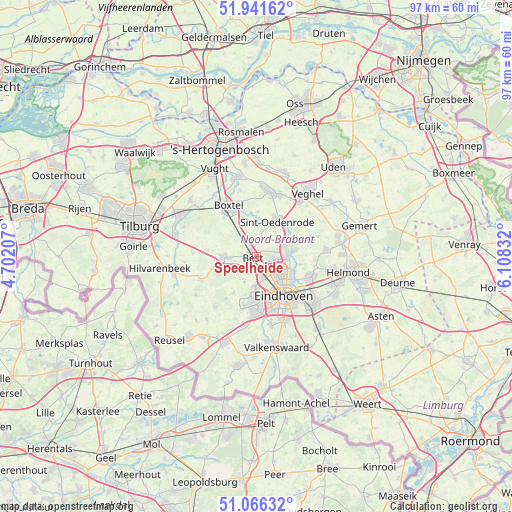
Speelheide GPS coordinates[2]
51° 30' 21.852" North, 5° 24' 18.684" East
| Map corner | latitude | longitude |
|---|---|---|
| Upper-left | 51.94162°, | 4.70207° |
| Center: | 51.50607°, | 5.40519° |
| Lower-right: | 51.06632°, | 6.10832° |
| Map W x H: | 97.3×97.3 km | = 60.5×60.5mi |
| max Lat: | 53.48025° ⇑80.3% North |
| Speelheide: | 51.50607° |
| min Lat: | ⇓19.7% South 50.76917° |
| min Long | Speelheide | max Long |
| 3.38611° | 5.40519° | 7.16528° |
| W 39.7%⇐ | ⇒60.3% E |
Elevation
Elevation of Speelheide is 20 m = 66 ft, and this is 5 m = 16 ft above average elevation for this country.
| Max E: |
203 m = 666 ft | 21.2% |
| Speelheide | 20 m 66 ft | |
| Avg. | 15 m = 49 ft | |
Min E: |
-6 m = -20 ft | 78.8% |
See also: Netherlands elevation on elevation.city.
Geographical zone
Speelheide is located in North temperate zone (between Tropic of Cancer and the Arctic Circle). Distance of this North polar circle is 1674.2 km =1040.3 mi to North.| Distance of | km | miles | from Speelheide |
|---|---|---|---|
| North Pole | 4280.1 | 2659.5 | to North |
| Arctic Circle | 1674.2 | 1040.3 | to North |
| Tropic Cancer | 3121 | 1939.3 | to South |
| Equator | 5726.9 | 3558.5 | to South |


Nearby cities:
15 places around Speelheide: (largest is in red/bold)
• Batadorp
1.9 km =1.2 mi,  192°
192°
• Best
1 km =0.6 mi,  278°
278°
• Boskant
5 km =3.1 mi,  12°
12°
• Heesterakker
6.7 km =4.2 mi,  109°
109°
• Jagershoef
5.6 km =3.5 mi,  130°
130°
• Meerhoven
7.1 km =4.4 mi,  176°
176°
• Naastenbest
1.3 km =0.8 mi,  264°
264°
• Oirschot
6.3 km =3.9 mi,  268°
268°
• Salderes
1.5 km =0.9 mi,  313°
313°
• Son
6.1 km =3.8 mi,  84°
84°
• Son en Breugel
6.4 km =4 mi, 79°
• Vaartbroek
7.1 km =4.4 mi, 114°
• Vlokhoven
7 km =4.3 mi, 128°
• Wilhelminadorp
1.3 km =0.8 mi,  223°
223°
• Woenselse Heide
5 km =3.1 mi,  120°
120°
Sources, notices
• [Note1] Compared only with cities in Netherlands existing in our database
• [Src1] Map data: © OpenStreetMap contributors (CC-BY-SA)
• [Src2] Other city data from geonames.org with taken over terms of usage.
• [Src3] Geographical zone / Annual Mean Temperature by Robert A. Rohde @ Wikipedia
