Wilhelminadorp geodata
Wilhelminadorp (North Brabant) is a section of populated place; located in Netherlands in Europe/Amsterdam (GMT+2) time zone. With population of 3,645 people, there are 645 cities with bigger population in this country. Compared to other cities in Netherlands, 81.1% of cities are located further ↑North; 61% of cities are located further →East and 73.5% of cities have lower elevation than Wilhelminadorp. Note1


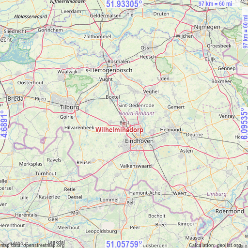
Wilhelminadorp GPS coordinates[2]
51° 29' 50.712" North, 5° 23' 32.028" East
| Map corner | latitude | longitude |
|---|---|---|
| Upper-left | 51.93305°, | 4.6891° |
| Center: | 51.49742°, | 5.39223° |
| Lower-right: | 51.05759°, | 6.09535° |
| Map W x H: | 97.3×97.3 km | = 60.5×60.5mi |
| max Lat: | 53.48025° ⇑81.1% North |
| Wilhelminadorp: | 51.49742° |
| min Lat: | ⇓18.9% South 50.76917° |
| min Long | Wilhelminadorp | max Long |
| 3.38611° | 5.39223° | 7.16528° |
| W 39%⇐ | ⇒61% E |
Elevation
Elevation of Wilhelminadorp is 17 m = 56 ft, and this is 2 m = 7 ft above average elevation for this country.
| Max E: |
203 m = 666 ft | 26.5% |
| Wilhelminadorp | 17 m 56 ft | |
| Avg. | 15 m = 49 ft | |
Min E: |
-6 m = -20 ft | 73.5% |
See also: Netherlands elevation on elevation.city.
Geographical zone
Wilhelminadorp is located in North temperate zone (between Tropic of Cancer and the Arctic Circle). Distance of this North polar circle is 1675.2 km =1040.9 mi to North.| Distance of | km | miles | from Wilhelminadorp |
|---|---|---|---|
| North Pole | 4281.1 | 2660.2 | to North |
| Arctic Circle | 1675.2 | 1040.9 | to North |
| Tropic Cancer | 3120.1 | 1938.7 | to South |
| Equator | 5726 | 3558 | to South |


Nearby cities:
15 places around Wilhelminadorp: (largest is in red/bold)
• Batadorp
1 km =0.6 mi,  151°
151°
• Best
1.1 km =0.7 mi,  353°
353°
• Boskant
6.2 km =3.9 mi,  18°
18°
• Grasrijk
6.7 km =4.2 mi,  166°
166°
• Heesterakker
7.3 km =4.5 mi,  99°
99°
• Jagershoef
5.8 km =3.6 mi,  117°
117°
• Lievendaal
6.8 km =4.2 mi, 154°
• Meerhoven
6.2 km =3.9 mi, 167°
• Naastenbest
0.9 km =0.6 mi,  331°
331°
• Oirschot
5.5 km =3.4 mi,  278°
278°
• Salderes
2 km =1.2 mi,  355°
355°
• Son
7.1 km =4.4 mi,  77°
77°
• Speelheide
1.3 km =0.8 mi,  43°
43°
• Vlokhoven
7.2 km =4.5 mi, 118°
• Woenselse Heide
5.4 km =3.4 mi,  106°
106°
Sources, notices
• [Note1] Compared only with cities in Netherlands existing in our database
• [Src1] Map data: © OpenStreetMap contributors (CC-BY-SA)
• [Src2] Other city data from geonames.org with taken over terms of usage.
• [Src3] Geographical zone / Annual Mean Temperature by Robert A. Rohde @ Wikipedia
