Matenhoeve geodata
Matenhoeve (Gelderland) is a section of populated place; located in Netherlands in Europe/Amsterdam (GMT+2) time zone. With population of 4,915 people, there are 493 cities with bigger population in this country. Compared to other cities in Netherlands, 59.4% of cities are located further ↓South; 73.8% of cities are located further ←West and 62% of cities have lower elevation than Matenhoeve. Note1


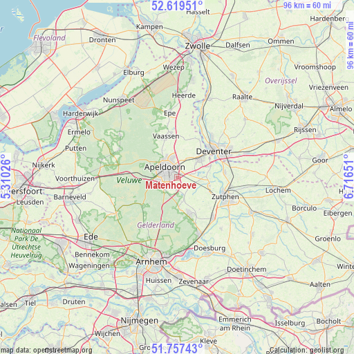
Matenhoeve GPS coordinates[2]
52° 11' 26.016" North, 6° 0' 48.168" East
| Map corner | latitude | longitude |
|---|---|---|
| Upper-left | 52.61951°, | 5.31026° |
| Center: | 52.19056°, | 6.01338° |
| Lower-right: | 51.75743°, | 6.71651° |
| Map W x H: | 95.9×95.9 km | = 59.6×59.6mi |
| max Lat: | 53.48025° ⇑40.6% North |
| Matenhoeve: | 52.19056° |
| min Lat: | ⇓59.4% South 50.76917° |
| min Long | Matenhoeve | max Long |
| 3.38611° | 6.01338° | 7.16528° |
| W 73.8%⇐ | ⇒26.2% E |
Elevation
Elevation of Matenhoeve is 11 m = 36 ft, and this is 4 m = 13 ft below average elevation for this country.
| Max E: |
203 m = 666 ft | 38% |
| Avg. | 15 m = 49 ft | |
| Matenhoeve | 11 m = 36 ft | |
Min E: |
-6 m = -20 ft | 62% |
See also: Netherlands elevation on elevation.city.
Geographical zone
Matenhoeve is located in North temperate zone (between Tropic of Cancer and the Arctic Circle). Distance of this North polar circle is 1598.1 km =993 mi to North.| Distance of | km | miles | from Matenhoeve |
|---|---|---|---|
| North Pole | 4204 | 2612.2 | to North |
| Arctic Circle | 1598.1 | 993 | to North |
| Tropic Cancer | 3197.1 | 1986.6 | to South |
| Equator | 5803 | 3605.8 | to South |


Nearby cities:
15 places around Matenhoeve: (largest is in red/bold)
• Brummelhof
3.5 km =2.2 mi,  297°
297°
• Componistenkwartier
3.2 km =2 mi,  268°
268°
• De Haven
3.5 km =2.2 mi,  309°
309°
• De Mheen
3.6 km =2.2 mi,  335°
335°
• Lieren
3.5 km =2.2 mi,  208°
208°
• Matendonk
0.8 km =0.5 mi,  349°
349°
• Matendreef
2.1 km =1.3 mi, 299°
• Matengaarde
1.5 km =0.9 mi, 304°
• Matenhorst
2.1 km =1.3 mi,  318°
318°
• Matenveld
1 km =0.6 mi,  252°
252°
• Rivierenkwartier
2.5 km =1.6 mi, 266°
• Staatsliedenkwartier
2.7 km =1.7 mi,  291°
291°
• Vogelkwartier
3.2 km =2 mi,  284°
284°
• Welgelegen
3.6 km =2.2 mi, 315°
• Woudhuis
2.5 km =1.6 mi,  356°
356°
Sources, notices
• [Note1] Compared only with cities in Netherlands existing in our database
• [Src1] Map data: © OpenStreetMap contributors (CC-BY-SA)
• [Src2] Other city data from geonames.org with taken over terms of usage.
• [Src3] Geographical zone / Annual Mean Temperature by Robert A. Rohde @ Wikipedia
