Uskedalen geodata
Uskedalen (Hordaland) is a populated place; located in Norway in Europe/Oslo (GMT+2) time zone. With population of 717 people, there are 378 cities with bigger population in this country. Compared to other cities in Norway, 66.1% of cities are located further ↑North; 84.2% of cities are located further →East and 82.9% of cities have higher elevation than Uskedalen. Note1


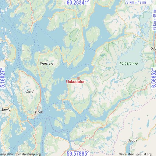
Uskedalen GPS coordinates[2]
59° 55' 58.8" North, 5° 51' 48.204" East
| Map corner | latitude | longitude |
|---|---|---|
| Upper-left | 60.28341°, | 5.16027° |
| Center: | 59.933°, | 5.86339° |
| Lower-right: | 59.57885°, | 6.56652° |
| Map W x H: | 78.3×78.3 km | = 48.7×48.7mi |
| max Lat: | 71.04137° ⇑66.1% North |
| Uskedalen: | 59.933° |
| min Lat: | ⇓33.9% South 58.0274° |
| min Long | Uskedalen | max Long |
| 4.71485° | 5.86339° | 31.11066° |
| W 15.8%⇐ | ⇒84.2% E |
Elevation
Elevation of Uskedalen is 9 m = 30 ft, and this is 95.2 m = 312 ft below average elevation for this country.
| Max E: |
897 m = 2943 ft | 82.9% |
| Avg. | 104.2 m = 342 ft | |
| Uskedalen | 9 m = 30 ft | |
Min E: |
1 m = 3 ft | 17.1% |
See also: Norway elevation on elevation.city.
Geographical zone
Uskedalen is located in North temperate zone (between Tropic of Cancer and the Arctic Circle). Distance of this North polar circle is 737.2 km =458.1 mi to North.| Distance of | km | miles | from Uskedalen |
|---|---|---|---|
| North Pole | 3343.1 | 2077.3 | to North |
| Arctic Circle | 737.2 | 458.1 | to North |
| Tropic Cancer | 4058 | 2521.5 | to South |
| Equator | 6663.9 | 4140.8 | to South |


Nearby cities:
15 places around Uskedalen: (largest is in red/bold)
• Eikelandsosen
35 km =21.7 mi,  349°
349°
• Etne
30.1 km =18.7 mi,  172°
172°
• Fitjar
30.5 km =19 mi,  266°
266°
• Leirvik
26.5 km =16.5 mi,  229°
229°
• Mosterhamn
37.3 km =23.2 mi, 225°
• Osøyro
35.6 km =22.1 mi,  321°
321°
• Rosendal
10.1 km =6.3 mi,  54°
54°
• Rubbestadneset
35.7 km =22.2 mi,  248°
248°
• Sagvåg
31.4 km =19.5 mi,  237°
237°
• Skånevik
22.6 km =14 mi, 169°
• Sæbøvik
17.7 km =11 mi,  209°
209°
• Uggdal
20.2 km =12.6 mi,  292°
292°
• Valvatna
31.1 km =19.3 mi, 233°
• Våge
22.6 km =14 mi,  302°
302°
• Ølen
36.7 km =22.8 mi,  184°
184°
Sources, notices
• [Note1] Compared only with cities in Norway existing in our database
• [Src1] Map data: © OpenStreetMap contributors (CC-BY-SA)
• [Src2] Other city data from geonames.org with taken over terms of usage.
• [Src3] Geographical zone / Annual Mean Temperature by Robert A. Rohde @ Wikipedia
