Tolga geodata
Tolga (Hedmark) is a seat of a second-order administrative division; located in Norway in Europe/Oslo (GMT+2) time zone. With population of 646 people, there are 400 cities with bigger population in this country. Compared to other cities in Norway, 67.2% of cities are located further ↓South; 67.1% of cities are located further ←West and 98.1% of cities have lower elevation than Tolga. Note1


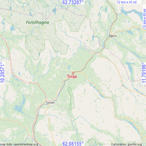
Tolga GPS coordinates[2]
62° 24' 32.328" North, 10° 59' 55.788" East
| Map corner | latitude | longitude |
|---|---|---|
| Upper-left | 62.73287°, | 10.29571° |
| Center: | 62.40898°, | 10.99883° |
| Lower-right: | 62.08155°, | 11.70196° |
| Map W x H: | 72.4×72.4 km | = 45×45mi |
| max Lat: | 71.04137° ⇑32.8% North |
| Tolga: | 62.40898° |
| min Lat: | ⇓67.2% South 58.0274° |
| min Long | Tolga | max Long |
| 4.71485° | 10.99883° | 31.11066° |
| W 67.1%⇐ | ⇒32.9% E |
Elevation
Elevation of Tolga is 560 m = 1837 ft, and this is 455.8 m = 1495 ft above average elevation for this country.
| Max E: |
897 m = 2943 ft | 1.9% |
| Tolga | 560 m 1837 ft | |
| Avg. | 104.2 m = 342 ft | |
Min E: |
1 m = 3 ft | 98.1% |
See also: Norway elevation on elevation.city.
Geographical zone
Tolga is located in North temperate zone (between Tropic of Cancer and the Arctic Circle). Distance of this North polar circle is 461.9 km =287 mi to North.| Distance of | km | miles | from Tolga |
|---|---|---|---|
| North Pole | 3067.8 | 1906.2 | to North |
| Arctic Circle | 461.9 | 287 | to North |
| Tropic Cancer | 4333.3 | 2692.6 | to South |
| Equator | 6939.2 | 4311.8 | to South |


Nearby cities:
15 places around Tolga: (largest is in red/bold)
• Aas
78.6 km =48.8 mi,  24°
24°
• Alvdal
38.5 km =23.9 mi,  209°
209°
• Bergset
57.7 km =35.9 mi,  175°
175°
• Berkåk
68.5 km =42.6 mi,  312°
312°
• Engerdal
87.9 km =54.6 mi,  145°
145°
• Folldal
60.3 km =37.5 mi,  239°
239°
• Hovin
86.9 km =54 mi,  333°
333°
• Lundamo
90.2 km =56 mi,  336°
336°
• Oppdal
70.2 km =43.6 mi,  287°
287°
• Os
15.1 km =9.4 mi,  49°
49°
• Røros
27 km =16.8 mi, 47°
• Støren
78.9 km =49 mi, 332°
• Svarstad
79.6 km =49.5 mi,  171°
171°
• Tynset
18.5 km =11.5 mi,  217°
217°
• Ålen
50.6 km =31.4 mi, 17°
Sources, notices
• [Note1] Compared only with cities in Norway existing in our database
• [Src1] Map data: © OpenStreetMap contributors (CC-BY-SA)
• [Src2] Other city data from geonames.org with taken over terms of usage.
• [Src3] Geographical zone / Annual Mean Temperature by Robert A. Rohde @ Wikipedia
