Tynset geodata
Tynset (Hedmark) is a seat of a second-order administrative division; located in Norway in Europe/Oslo (GMT+2) time zone. With population of 2,356 people, there are 169 cities with bigger population in this country. Compared to other cities in Norway, 65.7% of cities are located further ↓South; 63.8% of cities are located further ←West and 97% of cities have lower elevation than Tynset. Note1


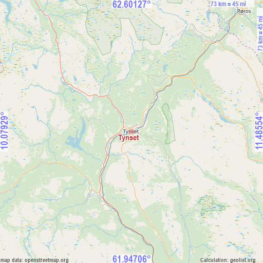
Tynset GPS coordinates[2]
62° 16' 33.384" North, 10° 46' 56.676" East
| Map corner | latitude | longitude |
|---|---|---|
| Upper-left | 62.60127°, | 10.07929° |
| Center: | 62.27594°, | 10.78241° |
| Lower-right: | 61.94706°, | 11.48554° |
| Map W x H: | 72.7×72.7 km | = 45.2×45.2mi |
| max Lat: | 71.04137° ⇑34.3% North |
| Tynset: | 62.27594° |
| min Lat: | ⇓65.7% South 58.0274° |
| min Long | Tynset | max Long |
| 4.71485° | 10.78241° | 31.11066° |
| W 63.8%⇐ | ⇒36.2% E |
Elevation
Elevation of Tynset is 483 m = 1585 ft, and this is 378.8 m = 1243 ft above average elevation for this country.
| Max E: |
897 m = 2943 ft | 3% |
| Tynset | 483 m 1585 ft | |
| Avg. | 104.2 m = 342 ft | |
Min E: |
1 m = 3 ft | 97% |
See also: Norway elevation on elevation.city.
Geographical zone
Tynset is located in North temperate zone (between Tropic of Cancer and the Arctic Circle). Distance of this North polar circle is 476.7 km =296.2 mi to North.| Distance of | km | miles | from Tynset |
|---|---|---|---|
| North Pole | 3082.6 | 1915.4 | to North |
| Arctic Circle | 476.7 | 296.2 | to North |
| Tropic Cancer | 4318.5 | 2683.4 | to South |
| Equator | 6924.4 | 4302.6 | to South |


Nearby cities:
15 places around Tynset: (largest is in red/bold)
• Alvdal
20.3 km =12.6 mi,  202°
202°
• Bergset
45.5 km =28.3 mi,  160°
160°
• Berkåk
72.7 km =45.2 mi,  327°
327°
• Dale
87.2 km =54.2 mi,  230°
230°
• Dovre
85.6 km =53.2 mi,  247°
247°
• Engerdal
84.1 km =52.3 mi,  133°
133°
• Folldal
43.7 km =27.2 mi, 248°
• Koppang
79.5 km =49.4 mi,  169°
169°
• Oppdal
66.4 km =41.3 mi,  302°
302°
• Os
33.4 km =20.8 mi,  42°
42°
• Otta
85.9 km =53.4 mi, 229°
• Røros
45.4 km =28.2 mi, 42°
• Svarstad
67.9 km =42.2 mi, 160°
• Tolga
18.5 km =11.5 mi, 37°
• Ålen
68.3 km =42.4 mi,  22°
22°
Sources, notices
• [Note1] Compared only with cities in Norway existing in our database
• [Src1] Map data: © OpenStreetMap contributors (CC-BY-SA)
• [Src2] Other city data from geonames.org with taken over terms of usage.
• [Src3] Geographical zone / Annual Mean Temperature by Robert A. Rohde @ Wikipedia
