Farnes geodata
Farnes (Sogn og Fjordane) is a populated locality; located in Norway in Europe/Oslo (GMT+2) time zone. With population of 3,465 people, there are 120 cities with bigger population in this country. Compared to other cities in Norway, 59% of cities are located further ↓South; 68.5% of cities are located further →East and 54.9% of cities have lower elevation than Farnes. Note1


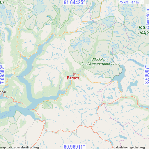
Farnes GPS coordinates[2]
61° 18' 30.6" North, 7° 47' 48.984" East
| Map corner | latitude | longitude |
|---|---|---|
| Upper-left | 61.64425°, | 7.09382° |
| Center: | 61.3085°, | 7.79694° |
| Lower-right: | 60.96911°, | 8.50007° |
| Map W x H: | 75.1×75.1 km | = 46.7×46.7mi |
| max Lat: | 71.04137° ⇑41% North |
| Farnes: | 61.3085° |
| min Lat: | ⇓59% South 58.0274° |
| min Long | Farnes | max Long |
| 4.71485° | 7.79694° | 31.11066° |
| W 31.5%⇐ | ⇒68.5% E |
Elevation
Elevation of Farnes is 60 m = 197 ft, and this is 44.2 m = 145 ft below average elevation for this country.
| Max E: |
897 m = 2943 ft | 45.1% |
| Avg. | 104.2 m = 342 ft | |
| Farnes | 60 m = 197 ft | |
Min E: |
1 m = 3 ft | 54.9% |
See also: Norway elevation on elevation.city.
Geographical zone
Farnes is located in North temperate zone (between Tropic of Cancer and the Arctic Circle). Distance of this North polar circle is 584.3 km =363.1 mi to North.| Distance of | km | miles | from Farnes |
|---|---|---|---|
| North Pole | 3190.2 | 1982.3 | to North |
| Arctic Circle | 584.3 | 363.1 | to North |
| Tropic Cancer | 4210.9 | 2616.5 | to South |
| Equator | 6816.9 | 4235.8 | to South |


Nearby cities:
15 places around Farnes: (largest is in red/bold)
• Aurlandsvangen
55.5 km =34.5 mi,  216°
216°
• Balestrand
68.3 km =42.4 mi,  260°
260°
• Bismo
68.6 km =42.6 mi,  21°
21°
• Bismoen
68.6 km =42.6 mi, 21°
• Gaupne
28.8 km =17.9 mi,  291°
291°
• Hemsedal
64.1 km =39.8 mi,  140°
140°
• Hermansverk
52.5 km =32.6 mi,  254°
254°
• Kaupanger
32.7 km =20.3 mi, 245°
• Lærdalsøyri
28.9 km =18 mi, 216°
• Slidre
68 km =42.3 mi,  111°
111°
• Sogndal
38.5 km =23.9 mi, 256°
• Sogndalsfjøra
38.3 km =23.8 mi, 256°
• Trøim
64.7 km =40.2 mi, 140°
• Vang
46.3 km =28.8 mi,  116°
116°
• Årdalstangen
9.5 km =5.9 mi,  211°
211°
Sources, notices
• [Note1] Compared only with cities in Norway existing in our database
• [Src1] Map data: © OpenStreetMap contributors (CC-BY-SA)
• [Src2] Other city data from geonames.org with taken over terms of usage.
• [Src3] Geographical zone / Annual Mean Temperature by Robert A. Rohde @ Wikipedia
