Årdalstangen geodata
Årdalstangen (Sogn og Fjordane) is a seat of a second-order administrative division; located in Norway in Europe/Oslo (GMT+2) time zone. With population of 1,510 people, there are 239 cities with bigger population in this country. Compared to other cities in Norway, 58.9% of cities are located further ↓South; 69.1% of cities are located further →East and 69% of cities have higher elevation than Årdalstangen. Note1


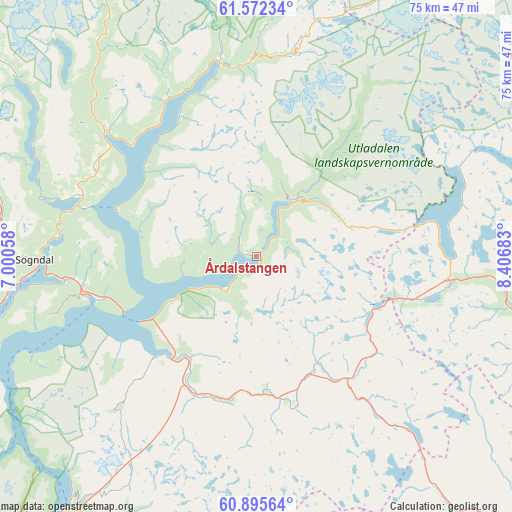
Årdalstangen GPS coordinates[2]
61° 14' 8.916" North, 7° 42' 13.32" East
| Map corner | latitude | longitude |
|---|---|---|
| Upper-left | 61.57234°, | 7.00058° |
| Center: | 61.23581°, | 7.7037° |
| Lower-right: | 60.89564°, | 8.40683° |
| Map W x H: | 75.2×75.2 km | = 46.7×46.7mi |
| max Lat: | 71.04137° ⇑41.1% North |
| Årdalstangen: | 61.23581° |
| min Lat: | ⇓58.9% South 58.0274° |
| min Long | Årdalstangen | max Long |
| 4.71485° | 7.7037° | 31.11066° |
| W 30.9%⇐ | ⇒69.1% E |
Elevation
Elevation of Årdalstangen is 20 m = 66 ft, and this is 84.2 m = 276 ft below average elevation for this country.
| Max E: |
897 m = 2943 ft | 69% |
| Avg. | 104.2 m = 342 ft | |
| Årdalstangen | 20 m = 66 ft | |
Min E: |
1 m = 3 ft | 31% |
See also: Norway elevation on elevation.city.
Geographical zone
Årdalstangen is located in North temperate zone (between Tropic of Cancer and the Arctic Circle). Distance of this North polar circle is 592.4 km =368.1 mi to North.| Distance of | km | miles | from Årdalstangen |
|---|---|---|---|
| North Pole | 3198.3 | 1987.3 | to North |
| Arctic Circle | 592.4 | 368.1 | to North |
| Tropic Cancer | 4202.9 | 2611.6 | to South |
| Equator | 6808.8 | 4230.8 | to South |


Nearby cities:
15 places around Årdalstangen: (largest is in red/bold)
• Aurlandsvangen
46 km =28.6 mi,  217°
217°
• Balestrand
62.6 km =38.9 mi,  267°
267°
• Farnes
9.5 km =5.9 mi,  31°
31°
• Gaupne
28.8 km =17.9 mi,  310°
310°
• Hemsedal
61.7 km =38.3 mi,  132°
132°
• Hermansverk
46.1 km =28.6 mi,  262°
262°
• Kaupanger
25.3 km =15.7 mi, 256°
• Lærdalsøyri
19.5 km =12.1 mi, 219°
• Slidre
70.5 km =43.8 mi,  103°
103°
• Sogndal
32.5 km =20.2 mi, 268°
• Sogndalsfjøra
32.2 km =20 mi, 268°
• Trøim
62.3 km =38.7 mi, 131°
• Vang
48.2 km =30 mi, 104°
• Vik
63.6 km =39.5 mi,  251°
251°
• Vikøyri
62.5 km =38.8 mi, 254°
Sources, notices
• [Note1] Compared only with cities in Norway existing in our database
• [Src1] Map data: © OpenStreetMap contributors (CC-BY-SA)
• [Src2] Other city data from geonames.org with taken over terms of usage.
• [Src3] Geographical zone / Annual Mean Temperature by Robert A. Rohde @ Wikipedia
