Gaupne geodata
Gaupne (Sogn og Fjordane) is a seat of a second-order administrative division; located in Norway in Europe/Oslo (GMT+2) time zone. With population of 1,157 people, there are 279 cities with bigger population in this country. Compared to other cities in Norway, 60% of cities are located further ↓South; 71.4% of cities are located further →East and 52.7% of cities have higher elevation than Gaupne. Note1


Gaupne GPS coordinates[2]
61° 24' 16.992" North, 7° 17' 40.488" East
| Map corner | latitude | longitude |
|---|---|---|
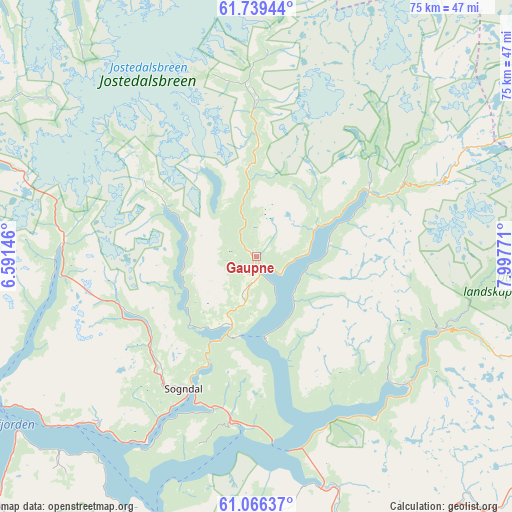
| Upper-left | 61.73944°, | 6.59146° |
| Center: | 61.40472°, | 7.29458° |
| Lower-right: | 61.06637°, | 7.99771° |
| Map W x H: | 74.8×74.8 km | = 46.5×46.5mi |
| max Lat: | 71.04137° ⇑40% North |
| Gaupne: | 61.40472° |
| min Lat: | ⇓60% South 58.0274° |
| min Long | Gaupne | max Long |
| 4.71485° | 7.29458° | 31.11066° |
| W 28.6%⇐ | ⇒71.4% E |
Elevation
Elevation of Gaupne is 40 m = 131 ft, and this is 64.2 m = 211 ft below average elevation for this country.
| Max E: |
897 m = 2943 ft | 52.7% |
| Avg. | 104.2 m = 342 ft | |
| Gaupne | 40 m = 131 ft | |
Min E: |
1 m = 3 ft | 47.3% |
See also: Norway elevation on elevation.city.
Geographical zone
Gaupne is located in North temperate zone (between Tropic of Cancer and the Arctic Circle). Distance of this North polar circle is 573.6 km =356.4 mi to North.| Distance of | km | miles | from Gaupne |
|---|---|---|---|
| North Pole | 3179.5 | 1975.6 | to North |
| Arctic Circle | 573.6 | 356.4 | to North |
| Tropic Cancer | 4221.6 | 2623.2 | to South |
| Equator | 6827.6 | 4242.5 | to South |


Nearby cities:
15 places around Gaupne: (largest is in red/bold)
• Aurlandsvangen
55.8 km =34.7 mi,  185°
185°
• Balestrand
45.9 km =28.5 mi,  241°
241°
• Farnes
28.8 km =17.9 mi,  111°
111°
• Hermansverk
34.1 km =21.2 mi,  224°
224°
• Høyanger
67.6 km =42 mi,  252°
252°
• Kaupanger
24.6 km =15.3 mi, 186°
• Lærdalsøyri
35.2 km =21.9 mi,  164°
164°
• Sandane
70.3 km =43.7 mi,  305°
305°
• Skei
47.1 km =29.3 mi,  293°
293°
• Sogndal
22.2 km =13.8 mi,  208°
208°
• Sogndalsfjøra
22.4 km =13.9 mi, 207°
• Stryn
63.2 km =39.3 mi,  331°
331°
• Vik
54.4 km =33.8 mi, 224°
• Vikøyri
52.1 km =32.4 mi,  227°
227°
• Årdalstangen
28.8 km =17.9 mi,  130°
130°
Sources, notices
• [Note1] Compared only with cities in Norway existing in our database
• [Src1] Map data: © OpenStreetMap contributors (CC-BY-SA)
• [Src2] Other city data from geonames.org with taken over terms of usage.
• [Src3] Geographical zone / Annual Mean Temperature by Robert A. Rohde @ Wikipedia
