Balestrand geodata
Balestrand (Sogn og Fjordane) is a seat of a second-order administrative division; located in Norway in Europe/Oslo (GMT+2) time zone. With population of 769 people, there are 364 cities with bigger population in this country. Compared to other cities in Norway, 57.8% of cities are located further ↓South; 78.3% of cities are located further →East and 58.2% of cities have higher elevation than Balestrand. Note1


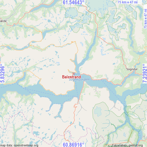
Balestrand GPS coordinates[2]
61° 12' 34.632" North, 6° 32' 9.888" East
| Map corner | latitude | longitude |
|---|---|---|
| Upper-left | 61.54643°, | 5.83296° |
| Center: | 61.20962°, | 6.53608° |
| Lower-right: | 60.86916°, | 7.23921° |
| Map W x H: | 75.3×75.3 km | = 46.8×46.8mi |
| max Lat: | 71.04137° ⇑42.2% North |
| Balestrand: | 61.20962° |
| min Lat: | ⇓57.8% South 58.0274° |
| min Long | Balestrand | max Long |
| 4.71485° | 6.53608° | 31.11066° |
| W 21.7%⇐ | ⇒78.3% E |
Elevation
Elevation of Balestrand is 30 m = 98 ft, and this is 74.2 m = 243 ft below average elevation for this country.
| Max E: |
897 m = 2943 ft | 58.2% |
| Avg. | 104.2 m = 342 ft | |
| Balestrand | 30 m = 98 ft | |
Min E: |
1 m = 3 ft | 41.8% |
See also: Norway elevation on elevation.city.
Geographical zone
Balestrand is located in North temperate zone (between Tropic of Cancer and the Arctic Circle). Distance of this North polar circle is 595.3 km =369.9 mi to North.| Distance of | km | miles | from Balestrand |
|---|---|---|---|
| North Pole | 3201.2 | 1989.1 | to North |
| Arctic Circle | 595.3 | 369.9 | to North |
| Tropic Cancer | 4200 | 2609.8 | to South |
| Equator | 6805.9 | 4229 | to South |


Nearby cities:
15 places around Balestrand: (largest is in red/bold)
• Aurlandsvangen
48.7 km =30.3 mi,  133°
133°
• Førde
45.2 km =28.1 mi,  306°
306°
• Gaupne
45.9 km =28.5 mi,  61°
61°
• Hermansverk
17.1 km =10.6 mi,  99°
99°
• Høyanger
24.2 km =15 mi,  273°
273°
• Kaupanger
37.9 km =23.5 mi,  94°
94°
• Lærdalsøyri
51.8 km =32.2 mi, 103°
• Mo
58.8 km =36.5 mi,  221°
221°
• Naustdal
55 km =34.2 mi, 307°
• Sande
41.5 km =25.8 mi,  288°
288°
• Skei
40.4 km =25.1 mi,  355°
355°
• Sogndal
30.1 km =18.7 mi, 85°
• Sogndalsfjøra
30.3 km =18.8 mi, 86°
• Vik
17.1 km =10.6 mi,  172°
172°
• Vikøyri
13.8 km =8.6 mi, 170°
Sources, notices
• [Note1] Compared only with cities in Norway existing in our database
• [Src1] Map data: © OpenStreetMap contributors (CC-BY-SA)
• [Src2] Other city data from geonames.org with taken over terms of usage.
• [Src3] Geographical zone / Annual Mean Temperature by Robert A. Rohde @ Wikipedia
