Lysaker geodata
Lysaker (Akershus) is a populated place; located in Norway in Europe/Oslo (GMT+2) time zone. With population of 3,439 people, there are 121 cities with bigger population in this country. Compared to other cities in Norway, 67.6% of cities are located further ↑North; 61.2% of cities are located further ←West and 52.8% of cities have lower elevation than Lysaker. Note1


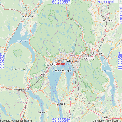
Lysaker GPS coordinates[2]
59° 54' 35.784" North, 10° 38' 7.62" East
| Map corner | latitude | longitude |
|---|---|---|
| Upper-left | 60.26059°, | 9.93232° |
| Center: | 59.90994°, | 10.63545° |
| Lower-right: | 59.55554°, | 11.33858° |
| Map W x H: | 78.4×78.4 km | = 48.7×48.7mi |
| max Lat: | 71.04137° ⇑67.6% North |
| Lysaker: | 59.90994° |
| min Lat: | ⇓32.4% South 58.0274° |
| min Long | Lysaker | max Long |
| 4.71485° | 10.63545° | 31.11066° |
| W 61.2%⇐ | ⇒38.8% E |
Elevation
Elevation of Lysaker is 50 m = 164 ft, and this is 54.2 m = 178 ft below average elevation for this country.
| Max E: |
897 m = 2943 ft | 47.2% |
| Avg. | 104.2 m = 342 ft | |
| Lysaker | 50 m = 164 ft | |
Min E: |
1 m = 3 ft | 52.8% |
See also: Norway elevation on elevation.city.
Geographical zone
Lysaker is located in North temperate zone (between Tropic of Cancer and the Arctic Circle). Distance of this North polar circle is 739.8 km =459.7 mi to North.| Distance of | km | miles | from Lysaker |
|---|---|---|---|
| North Pole | 3345.7 | 2078.9 | to North |
| Arctic Circle | 739.8 | 459.7 | to North |
| Tropic Cancer | 4055.4 | 2519.9 | to South |
| Equator | 6661.4 | 4139.2 | to South |


Nearby cities:
15 places around Lysaker: (largest is in red/bold)
• Asker
14 km =8.7 mi,  232°
232°
• Billingstad
9.4 km =5.8 mi,  245°
245°
• Blakstad
13.9 km =8.6 mi,  223°
223°
• Fagerstrand
19.3 km =12 mi,  186°
186°
• Fjellstrand
13 km =8.1 mi, 187°
• Kjenn
17.9 km =11.1 mi,  82°
82°
• Kolbotn
14.5 km =9 mi,  139°
139°
• Nesoddtangen
5.5 km =3.4 mi,  163°
163°
• Oslo
6.2 km =3.9 mi,  87°
87°
• Sandvika
6.4 km =4 mi, 250°
• Sjølyststranda
2.8 km =1.7 mi,  63°
63°
• Skui
10.7 km =6.6 mi,  280°
280°
• Slemmestad
16.3 km =10.1 mi,  208°
208°
• Smestad
11.6 km =7.2 mi, 283°
• Sylling
19.3 km =12 mi,  264°
264°
Sources, notices
• [Note1] Compared only with cities in Norway existing in our database
• [Src1] Map data: © OpenStreetMap contributors (CC-BY-SA)
• [Src2] Other city data from geonames.org with taken over terms of usage.
• [Src3] Geographical zone / Annual Mean Temperature by Robert A. Rohde @ Wikipedia
