Nordfjordeid geodata
Nordfjordeid (Sogn og Fjordane) is a seat of a second-order administrative division; located in Norway in Europe/Oslo (GMT+2) time zone. With population of 2,553 people, there are 147 cities with bigger population in this country. Compared to other cities in Norway, 63.4% of cities are located further ↓South; 83.2% of cities are located further →East and 62.5% of cities have higher elevation than Nordfjordeid. Note1


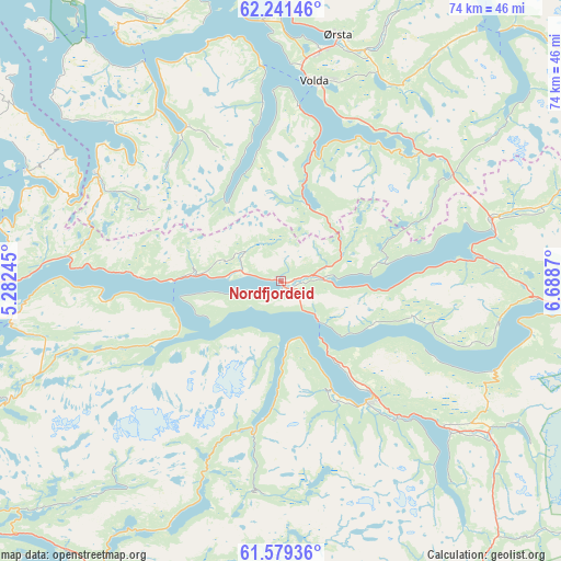
Nordfjordeid GPS coordinates[2]
61° 54' 43.92" North, 5° 59' 8.052" East
| Map corner | latitude | longitude |
|---|---|---|
| Upper-left | 62.24146°, | 5.28245° |
| Center: | 61.9122°, | 5.98557° |
| Lower-right: | 61.57936°, | 6.6887° |
| Map W x H: | 73.6×73.6 km | = 45.7×45.7mi |
| max Lat: | 71.04137° ⇑36.6% North |
| Nordfjordeid: | 61.9122° |
| min Lat: | ⇓63.4% South 58.0274° |
| min Long | Nordfjordeid | max Long |
| 4.71485° | 5.98557° | 31.11066° |
| W 16.8%⇐ | ⇒83.2% E |
Elevation
Elevation of Nordfjordeid is 25 m = 82 ft, and this is 79.2 m = 260 ft below average elevation for this country.
| Max E: |
897 m = 2943 ft | 62.5% |
| Avg. | 104.2 m = 342 ft | |
| Nordfjordeid | 25 m = 82 ft | |
Min E: |
1 m = 3 ft | 37.5% |
See also: Norway elevation on elevation.city.
Geographical zone
Nordfjordeid is located in North temperate zone (between Tropic of Cancer and the Arctic Circle). Distance of this North polar circle is 517.2 km =321.4 mi to North.| Distance of | km | miles | from Nordfjordeid |
|---|---|---|---|
| North Pole | 3123.1 | 1940.6 | to North |
| Arctic Circle | 517.2 | 321.4 | to North |
| Tropic Cancer | 4278.1 | 2658.3 | to South |
| Equator | 6884 | 4277.5 | to South |


Nearby cities:
15 places around Nordfjordeid: (largest is in red/bold)
• Fiskå
30.6 km =19 mi,  313°
313°
• Hornindal
28.9 km =18 mi,  77°
77°
• Larsnes
38.7 km =24 mi,  326°
326°
• Måløy
45.7 km =28.4 mi,  273°
273°
• Naustdal
46.8 km =29.1 mi,  197°
197°
• Raudeberg
45.1 km =28 mi,  280°
280°
• Sandane
19.6 km =12.2 mi,  142°
142°
• Selje
36.4 km =22.6 mi,  293°
293°
• Skei
45.9 km =28.5 mi,  145°
145°
• Stryn
38.4 km =23.9 mi,  91°
91°
• Svelgen
39.5 km =24.5 mi,  246°
246°
• Ulsteinvik
48.4 km =30.1 mi,  351°
351°
• Ulsteinvik weather pws station
48.5 km =30.1 mi, 351°
• Volda
26.4 km =16.4 mi,  9°
9°
• Ørsta
32.8 km =20.4 mi, 13°
Sources, notices
• [Note1] Compared only with cities in Norway existing in our database
• [Src1] Map data: © OpenStreetMap contributors (CC-BY-SA)
• [Src2] Other city data from geonames.org with taken over terms of usage.
• [Src3] Geographical zone / Annual Mean Temperature by Robert A. Rohde @ Wikipedia
