Hornindal geodata
Hornindal (Sogn og Fjordane) is a seat of a second-order administrative division; located in Norway in Europe/Oslo (GMT+2) time zone. In our database, there are 488 cities with bigger population. Compared to other cities in Norway, 63.8% of cities are located further ↓South; 78.5% of cities are located further →East and 64.9% of cities have lower elevation than Hornindal. Note1


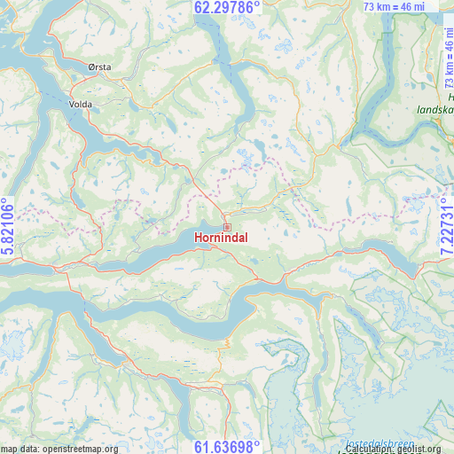
Hornindal GPS coordinates[2]
61° 58' 9.156" North, 6° 31' 27.048" East
| Map corner | latitude | longitude |
|---|---|---|
| Upper-left | 62.29786°, | 5.82106° |
| Center: | 61.96921°, | 6.52418° |
| Lower-right: | 61.63698°, | 7.22731° |
| Map W x H: | 73.5×73.5 km | = 45.7×45.7mi |
| max Lat: | 71.04137° ⇑36.2% North |
| Hornindal: | 61.96921° |
| min Lat: | ⇓63.8% South 58.0274° |
| min Long | Hornindal | max Long |
| 4.71485° | 6.52418° | 31.11066° |
| W 21.5%⇐ | ⇒78.5% E |
Elevation
Elevation of Hornindal is 92 m = 302 ft, and this is 12.2 m = 40 ft below average elevation for this country.
| Max E: |
897 m = 2943 ft | 35.1% |
| Avg. | 104.2 m = 342 ft | |
| Hornindal | 92 m = 302 ft | |
Min E: |
1 m = 3 ft | 64.9% |
See also: Norway elevation on elevation.city.
Geographical zone
Hornindal is located in North temperate zone (between Tropic of Cancer and the Arctic Circle). Distance of this North polar circle is 510.8 km =317.4 mi to North.| Distance of | km | miles | from Hornindal |
|---|---|---|---|
| North Pole | 3116.7 | 1936.6 | to North |
| Arctic Circle | 510.8 | 317.4 | to North |
| Tropic Cancer | 4284.4 | 2662.2 | to South |
| Equator | 6890.3 | 4281.4 | to South |


Nearby cities:
15 places around Hornindal: (largest is in red/bold)
• Fiskå
52.5 km =32.6 mi,  286°
286°
• Hareid
51.5 km =32 mi,  330°
330°
• Ikornnes
46.4 km =28.8 mi,  1°
1°
• Nordfjordeid
28.9 km =18 mi,  257°
257°
• Sandane
27.2 km =16.9 mi,  216°
216°
• Skei
44.3 km =27.5 mi,  183°
183°
• Stordal
51.8 km =32.2 mi,  27°
27°
• Stranda
43.4 km =27 mi, 29°
• Stryn
12.6 km =7.8 mi,  126°
126°
• Sykkylven
47.6 km =29.6 mi, 3°
• Ulsteinvik
54.4 km =33.8 mi,  319°
319°
• Ulsteinvik weather pws station
54.6 km =33.9 mi, 319°
• Valldal
53 km =32.9 mi,  46°
46°
• Volda
30.7 km =19.1 mi,  309°
309°
• Ørsta
32.9 km =20.4 mi, 321°
Sources, notices
• [Note1] Compared only with cities in Norway existing in our database
• [Src1] Map data: © OpenStreetMap contributors (CC-BY-SA)
• [Src2] Other city data from geonames.org with taken over terms of usage.
• [Src3] Geographical zone / Annual Mean Temperature by Robert A. Rohde @ Wikipedia
