Andebu geodata
Andebu (Vestfold) is a seat of a second-order administrative division; located in Norway in Europe/Oslo (GMT+2) time zone. In our database, there are 488 cities with bigger population. Compared to other cities in Norway, 83.1% of cities are located further ↑North; 50.3% of cities are located further ←West and 59.2% of cities have lower elevation than Andebu. Note1


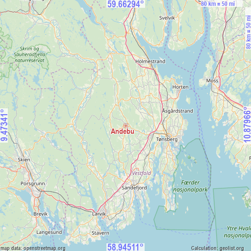
Andebu GPS coordinates[2]
59° 18' 21.312" North, 10° 10' 35.508" East
| Map corner | latitude | longitude |
|---|---|---|
| Upper-left | 59.66294°, | 9.47341° |
| Center: | 59.30592°, | 10.17653° |
| Lower-right: | 58.94511°, | 10.87966° |
| Map W x H: | 79.8×79.8 km | = 49.6×49.6mi |
| max Lat: | 71.04137° ⇑83.1% North |
| Andebu: | 59.30592° |
| min Lat: | ⇓16.9% South 58.0274° |
| min Long | Andebu | max Long |
| 4.71485° | 10.17653° | 31.11066° |
| W 50.3%⇐ | ⇒49.7% E |
Elevation
Elevation of Andebu is 61 m = 200 ft, and this is 43.2 m = 142 ft below average elevation for this country.
| Max E: |
897 m = 2943 ft | 40.8% |
| Avg. | 104.2 m = 342 ft | |
| Andebu | 61 m = 200 ft | |
Min E: |
1 m = 3 ft | 59.2% |
See also: Norway elevation on elevation.city.
Geographical zone
Andebu is located in North temperate zone (between Tropic of Cancer and the Arctic Circle). Distance of this North polar circle is 807 km =501.4 mi to North.| Distance of | km | miles | from Andebu |
|---|---|---|---|
| North Pole | 3412.9 | 2120.7 | to North |
| Arctic Circle | 807 | 501.4 | to North |
| Tropic Cancer | 3988.3 | 2478.2 | to South |
| Equator | 6594.2 | 4097.4 | to South |


Nearby cities:
15 places around Andebu: (largest is in red/bold)
• Barkåker
12.2 km =7.6 mi,  83°
83°
• Borgheim
15.8 km =9.8 mi,  124°
124°
• Holmestrand
21.7 km =13.5 mi,  21°
21°
• Horten
21.3 km =13.2 mi,  54°
54°
• Kvelde
17.3 km =10.7 mi,  223°
223°
• Melsomvik
12.9 km =8 mi,  135°
135°
• Nykirke
17.5 km =10.9 mi,  42°
42°
• Revetal
8.9 km =5.5 mi,  33°
33°
• Sandefjord
19.6 km =12.2 mi,  173°
173°
• Sem
9.1 km =5.7 mi,  106°
106°
• Skoppum
16 km =9.9 mi,  56°
56°
• Stokke
11.6 km =7.2 mi, 142°
• Tønsberg
13.8 km =8.6 mi, 108°
• Årøysund
21 km =13 mi,  130°
130°
• Åsgårdstrand
17.3 km =10.7 mi,  73°
73°
Sources, notices
• [Note1] Compared only with cities in Norway existing in our database
• [Src1] Map data: © OpenStreetMap contributors (CC-BY-SA)
• [Src2] Other city data from geonames.org with taken over terms of usage.
• [Src3] Geographical zone / Annual Mean Temperature by Robert A. Rohde @ Wikipedia
