Høylandet geodata
Høylandet (Trøndelag) is a seat of a second-order administrative division; located in Norway in Europe/Oslo (GMT+2) time zone. In our database, there are 488 cities with bigger population. Compared to other cities in Norway, 82% of cities are located further ↓South; 83.1% of cities are located further ←West and 62.5% of cities have higher elevation than Høylandet. Note1


Høylandet GPS coordinates[2]
64° 37' 43.932" North, 12° 18' 7.416" East
| Map corner | latitude | longitude |
|---|---|---|
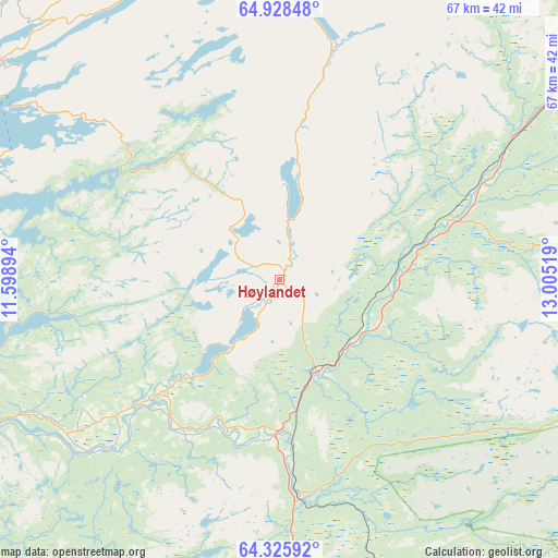
| Upper-left | 64.92848°, | 11.59894° |
| Center: | 64.62887°, | 12.30206° |
| Lower-right: | 64.32592°, | 13.00519° |
| Map W x H: | 67×67 km | = 41.6×41.6mi |
| max Lat: | 71.04137° ⇑18% North |
| Høylandet: | 64.62887° |
| min Lat: | ⇓82% South 58.0274° |
| min Long | Høylandet | max Long |
| 4.71485° | 12.30206° | 31.11066° |
| W 83.1%⇐ | ⇒16.9% E |
Elevation
Elevation of Høylandet is 25 m = 82 ft, and this is 79.2 m = 260 ft below average elevation for this country.
| Max E: |
897 m = 2943 ft | 62.5% |
| Avg. | 104.2 m = 342 ft | |
| Høylandet | 25 m = 82 ft | |
Min E: |
1 m = 3 ft | 37.5% |
See also: Norway elevation on elevation.city.
Geographical zone
Høylandet is located in North temperate zone (between Tropic of Cancer and the Arctic Circle). Distance of this North polar circle is 215.1 km =133.7 mi to North.| Distance of | km | miles | from Høylandet |
|---|---|---|---|
| North Pole | 2821 | 1752.9 | to North |
| Arctic Circle | 215.1 | 133.7 | to North |
| Tropic Cancer | 4580.1 | 2845.9 | to South |
| Equator | 7186.1 | 4465.2 | to South |


Nearby cities:
15 places around Høylandet: (largest is in red/bold)
• Bangsund
50.7 km =31.5 mi,  238°
238°
• Grong
18.3 km =11.4 mi,  177°
177°
• Jøa
49.5 km =30.8 mi,  273°
273°
• Kolvereid
42.3 km =26.3 mi,  308°
308°
• Lauvsnes
68.7 km =42.7 mi,  258°
258°
• Leknes
59.6 km =37 mi,  331°
331°
• Namsos
42.6 km =26.5 mi, 244°
• Namsskogan
52.6 km =32.7 mi,  50°
50°
• Ranemsletta
22.5 km =14 mi,  228°
228°
• Rørvik
56.7 km =35.2 mi,  297°
297°
• Røyrvik
66.2 km =41.1 mi,  64°
64°
• Sandvika
64.3 km =40 mi,  106°
106°
• Skage
31.7 km =19.7 mi, 235°
• Snåase
42.8 km =26.6 mi, 175°
• Terråk
51 km =31.7 mi,  3°
3°
Sources, notices
• [Note1] Compared only with cities in Norway existing in our database
• [Src1] Map data: © OpenStreetMap contributors (CC-BY-SA)
• [Src2] Other city data from geonames.org with taken over terms of usage.
• [Src3] Geographical zone / Annual Mean Temperature by Robert A. Rohde @ Wikipedia
