Røyrvik geodata
Røyrvik (Trøndelag) is a seat of a second-order administrative division; located in Norway in Europe/Oslo (GMT+1) time zone. With population of 254 people, there are 486 cities with bigger population in this country. Compared to other cities in Norway, 82.6% of cities are located further ↓South; 86.1% of cities are located further ←West and 96.4% of cities have lower elevation than Røyrvik. Note1


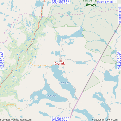
Røyrvik GPS coordinates[2]
64° 53' 2.184" North, 13° 33' 45.216" East
| Map corner | latitude | longitude |
|---|---|---|
| Upper-left | 65.18073°, | 12.85944° |
| Center: | 64.88394°, | 13.56256° |
| Lower-right: | 64.58383°, | 14.26569° |
| Map W x H: | 66.4×66.4 km | = 41.3×41.3mi |
| max Lat: | 71.04137° ⇑17.4% North |
| Røyrvik: | 64.88394° |
| min Lat: | ⇓82.6% South 58.0274° |
| min Long | Røyrvik | max Long |
| 4.71485° | 13.56256° | 31.11066° |
| W 86.1%⇐ | ⇒13.9% E |
Elevation
Elevation of Røyrvik is 469 m = 1539 ft, and this is 364.8 m = 1197 ft above average elevation for this country.
| Max E: |
897 m = 2943 ft | 3.6% |
| Røyrvik | 469 m 1539 ft | |
| Avg. | 104.2 m = 342 ft | |
Min E: |
1 m = 3 ft | 96.4% |
See also: Norway elevation on elevation.city.
Geographical zone
Røyrvik is located in North temperate zone (between Tropic of Cancer and the Arctic Circle). Distance of this North polar circle is 186.8 km =116.1 mi to North.| Distance of | km | miles | from Røyrvik |
|---|---|---|---|
| North Pole | 2792.6 | 1735.2 | to North |
| Arctic Circle | 186.8 | 116.1 | to North |
| Tropic Cancer | 4608.5 | 2863.6 | to South |
| Equator | 7214.4 | 4482.8 | to South |


Nearby cities:
15 places around Røyrvik: (largest is in red/bold)
• Brønnøysund
91 km =56.5 mi,  316°
316°
• Grong
75.4 km =46.9 mi,  231°
231°
• Hattfjelldal
81.8 km =50.8 mi,  14°
14°
• Høylandet
66.2 km =41.1 mi,  244°
244°
• Kolvereid
92.5 km =57.5 mi,  268°
268°
• Leknes
90.8 km =56.4 mi,  285°
285°
• Namsskogan
19.6 km =12.2 mi,  284°
284°
• Ranemsletta
88.1 km =54.7 mi, 240°
• Sandvika
46.7 km =29 mi,  178°
178°
• Skage
97.6 km =60.6 mi, 241°
• Snåase
90.8 km =56.4 mi,  218°
218°
• Terråk
60.4 km =37.5 mi, 291°
• Trofors
72.6 km =45.1 mi,  354°
354°
• Vevelstad
104.5 km =64.9 mi,  329°
329°
• Vik
80.9 km =50.3 mi,  306°
306°
Sources, notices
• [Note1] Compared only with cities in Norway existing in our database
• [Src1] Map data: © OpenStreetMap contributors (CC-BY-SA)
• [Src2] Other city data from geonames.org with taken over terms of usage.
• [Src3] Geographical zone / Annual Mean Temperature by Robert A. Rohde @ Wikipedia
