Skage geodata
Skage (Trøndelag) is a populated place; located in Norway in Europe/Oslo (GMT+2) time zone. With population of 603 people, there are 415 cities with bigger population in this country. Compared to other cities in Norway, 81.5% of cities are located further ↓South; 79.9% of cities are located further ←West and 54.9% of cities have lower elevation than Skage. Note1


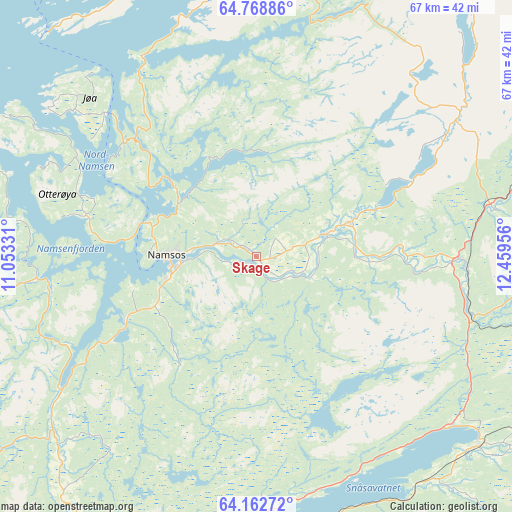
Skage GPS coordinates[2]
64° 28' 2.892" North, 11° 45' 23.148" East
| Map corner | latitude | longitude |
|---|---|---|
| Upper-left | 64.76886°, | 11.05331° |
| Center: | 64.46747°, | 11.75643° |
| Lower-right: | 64.16272°, | 12.45956° |
| Map W x H: | 67.4×67.4 km | = 41.9×41.9mi |
| max Lat: | 71.04137° ⇑18.5% North |
| Skage: | 64.46747° |
| min Lat: | ⇓81.5% South 58.0274° |
| min Long | Skage | max Long |
| 4.71485° | 11.75643° | 31.11066° |
| W 79.9%⇐ | ⇒20.1% E |
Elevation
Elevation of Skage is 60 m = 197 ft, and this is 44.2 m = 145 ft below average elevation for this country.
| Max E: |
897 m = 2943 ft | 45.1% |
| Avg. | 104.2 m = 342 ft | |
| Skage | 60 m = 197 ft | |
Min E: |
1 m = 3 ft | 54.9% |
See also: Norway elevation on elevation.city.
Geographical zone
Skage is located in North temperate zone (between Tropic of Cancer and the Arctic Circle). Distance of this North polar circle is 233.1 km =144.8 mi to North.| Distance of | km | miles | from Skage |
|---|---|---|---|
| North Pole | 2839 | 1764.1 | to North |
| Arctic Circle | 233.1 | 144.8 | to North |
| Tropic Cancer | 4562.2 | 2834.8 | to South |
| Equator | 7168.1 | 4454 | to South |


Nearby cities:
15 places around Skage: (largest is in red/bold)
• Bangsund
19.2 km =11.9 mi,  244°
244°
• Grong
26.8 km =16.7 mi,  90°
90°
• Høylandet
31.7 km =19.7 mi,  55°
55°
• Jøa
31.7 km =19.7 mi,  312°
312°
• Kolvereid
44.8 km =27.8 mi,  350°
350°
• Lauvsnes
41.5 km =25.8 mi,  275°
275°
• Malm
50.6 km =31.4 mi,  210°
210°
• Namdalseid
37.5 km =23.3 mi,  223°
223°
• Namsos
12.5 km =7.8 mi,  269°
269°
• Ranemsletta
9.7 km =6 mi,  71°
71°
• Rørvik
50.3 km =31.3 mi,  330°
330°
• Snåase
38.8 km =24.1 mi,  129°
129°
• Sparbu
63 km =39.1 mi,  194°
194°
• Steinkjer
51.9 km =32.2 mi, 194°
• Steinsdalen
62.7 km =39 mi,  252°
252°
Sources, notices
• [Note1] Compared only with cities in Norway existing in our database
• [Src1] Map data: © OpenStreetMap contributors (CC-BY-SA)
• [Src2] Other city data from geonames.org with taken over terms of usage.
• [Src3] Geographical zone / Annual Mean Temperature by Robert A. Rohde @ Wikipedia
