Terråk geodata
Terråk (Nordland) is a seat of a second-order administrative division; located in Norway in Europe/Oslo (GMT+2) time zone. With population of 623 people, there are 408 cities with bigger population in this country. Compared to other cities in Norway, 82.9% of cities are located further ↓South; 83.4% of cities are located further ←West and 69% of cities have higher elevation than Terråk. Note1


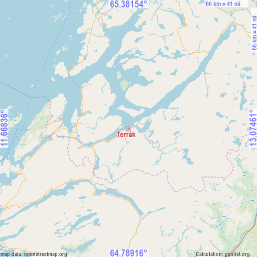
Terråk GPS coordinates[2]
65° 5' 13.2" North, 12° 22' 17.328" East
| Map corner | latitude | longitude |
|---|---|---|
| Upper-left | 65.38154°, | 11.66836° |
| Center: | 65.087°, | 12.37148° |
| Lower-right: | 64.78916°, | 13.07461° |
| Map W x H: | 65.9×65.9 km | = 40.9×40.9mi |
| max Lat: | 71.04137° ⇑17.1% North |
| Terråk: | 65.087° |
| min Lat: | ⇓82.9% South 58.0274° |
| min Long | Terråk | max Long |
| 4.71485° | 12.37148° | 31.11066° |
| W 83.4%⇐ | ⇒16.6% E |
Elevation
Elevation of Terråk is 20 m = 66 ft, and this is 84.2 m = 276 ft below average elevation for this country.
| Max E: |
897 m = 2943 ft | 69% |
| Avg. | 104.2 m = 342 ft | |
| Terråk | 20 m = 66 ft | |
Min E: |
1 m = 3 ft | 31% |
See also: Norway elevation on elevation.city.
Geographical zone
Terråk is located in North temperate zone (between Tropic of Cancer and the Arctic Circle). Distance of this North polar circle is 164.2 km =102 mi to North.| Distance of | km | miles | from Terråk |
|---|---|---|---|
| North Pole | 2770.1 | 1721.3 | to North |
| Arctic Circle | 164.2 | 102 | to North |
| Tropic Cancer | 4631.1 | 2877.6 | to South |
| Equator | 7237 | 4496.9 | to South |


Nearby cities:
15 places around Terråk: (largest is in red/bold)
• Brønnøysund
43.8 km =27.2 mi,  350°
350°
• Gladstad
68.3 km =42.4 mi,  343°
343°
• Grong
69.3 km =43.1 mi,  182°
182°
• Høylandet
51 km =31.7 mi, 183°
• Jøa
70.6 km =43.9 mi,  227°
227°
• Kolvereid
43.7 km =27.2 mi,  235°
235°
• Leknes
31.5 km =19.6 mi,  272°
272°
• Namsskogan
41 km =25.5 mi,  115°
115°
• Ranemsletta
68.9 km =42.8 mi,  196°
196°
• Rørvik
58.8 km =36.5 mi, 244°
• Røyrvik
60.4 km =37.5 mi,  111°
111°
• Skage
74.8 km =46.5 mi, 202°
• Trofors
69.1 km =42.9 mi,  44°
44°
• Vevelstad
68 km =42.3 mi,  2°
2°
• Vik
26.8 km =16.7 mi, 339°
Sources, notices
• [Note1] Compared only with cities in Norway existing in our database
• [Src1] Map data: © OpenStreetMap contributors (CC-BY-SA)
• [Src2] Other city data from geonames.org with taken over terms of usage.
• [Src3] Geographical zone / Annual Mean Temperature by Robert A. Rohde @ Wikipedia
