Hari Bdr Tamang House geodata
Hari Bdr Tamang House (Central Region) is a populated place; located in Nepal in Asia/Kathmandu (GMT+5.75) time zone. With population of 10,000 people, there are 44 cities with bigger population in this country. Compared to other cities in Nepal, 66.2% of cities are located further ↑North; 63.5% of cities are located further ←West and 79.7% of cities have lower elevation than Hari Bdr Tamang House. Note1


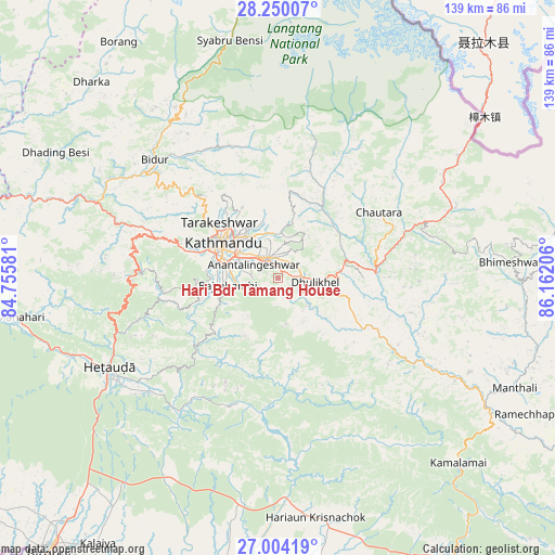
Hari Bdr Tamang House GPS coordinates[2]
27° 37' 44.04" North, 85° 27' 32.148" East
| Map corner | latitude | longitude |
|---|---|---|
| Upper-left | 28.25007°, | 84.75581° |
| Center: | 27.6289°, | 85.45893° |
| Lower-right: | 27.00419°, | 86.16206° |
| Map W x H: | 138.5×138.5 km | = 86.1×86.1mi |
| max Lat: | 30.04651° ⇑66.2% North |
| Hari Bdr Tamang House: | 27.6289° |
| min Lat: | ⇓33.8% South 26.45505° |
| min Long | Hari Bdr Tamang | max Long |
| 80.17715° | 85.45893° | 88.09436° |
| W 63.5%⇐ | ⇒36.5% E |
Elevation
Elevation of Hari Bdr Tamang House is 1703 m = 5587 ft, and this is 527.8 m = 1732 ft above average elevation for this country.
| Max E: |
5251 m = 17228 ft | 20.3% |
| Hari Bdr Tamang House | 1703 m 5587 ft | |
| Avg. | 1175.2 m = 3856 ft | |
Min E: |
72 m = 236 ft | 79.7% |
See also: Nepal elevation on elevation.city.
Geographical zone
Hari Bdr Tamang House is located in North temperate zone (between Tropic of Cancer and the Arctic Circle). Distance of this Northern Tropic circle is 466.1 km =289.6 mi to South.| Distance of | km | miles | from Hari Bdr Tamang House |
|---|---|---|---|
| North Pole | 6935 | 4309.2 | to North |
| Arctic Circle | 4329.1 | 2690 | to North |
| Tropic Cancer | 466.1 | 289.6 | to South |
| Equator | 3072 | 1908.9 | to South |


Nearby cities:
15 places around Hari Bdr Tamang House: (largest is in red/bold)
• Banepā
6.2 km =3.9 mi,  86°
86°
• Bhaktapur
5.7 km =3.5 mi,  329°
329°
• Chhetrapa1
65 km =40.4 mi, 85°
• Dhulikhel
8.3 km =5.2 mi,  95°
95°
• Hetauda
47.6 km =29.6 mi,  242°
242°
• Kathmandu
15.8 km =9.8 mi,  300°
300°
• Kirtipur
18.7 km =11.6 mi,  287°
287°
• Kothari
61.3 km =38.1 mi,  53°
53°
• Madhyapur Thimi
9.1 km =5.7 mi,  309°
309°
• Nagarkot
11.4 km =7.1 mi,  32°
32°
• Panauti
7.9 km =4.9 mi,  128°
128°
• Panauti̇̄
7.4 km =4.6 mi, 131°
• Pātan
15.2 km =9.4 mi, 290°
• Rāmechhāp
70.6 km =43.9 mi,  118°
118°
• kankrabari Dovan
0 km =0 mi, 103°
Sources, notices
• [Note1] Compared only with cities in Nepal existing in our database
• [Src1] Map data: © OpenStreetMap contributors (CC-BY-SA)
• [Src2] Other city data from geonames.org with taken over terms of usage.
• [Src3] Geographical zone / Annual Mean Temperature by Robert A. Rohde @ Wikipedia
