Hetauda geodata
Hetauda (Central Region) is a populated place; located in Nepal in Asia/Kathmandu (GMT+5.75) time zone. With population of 84,775 people, there are 11 cities with bigger population in this country. Compared to other cities in Nepal, 74.3% of cities are located further ↑North; 54.1% of cities are located further ←West and 63.5% of cities have higher elevation than Hetauda. Note1


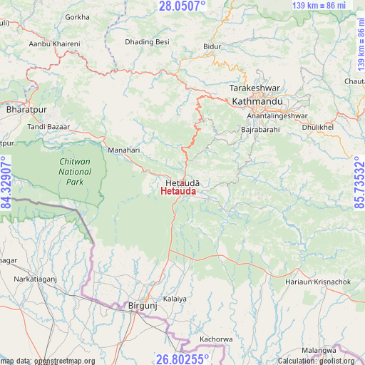
Hetauda GPS coordinates[2]
27° 25' 42.204" North, 85° 1' 55.884" East
| Map corner | latitude | longitude |
|---|---|---|
| Upper-left | 28.0507°, | 84.32907° |
| Center: | 27.42839°, | 85.03219° |
| Lower-right: | 26.80255°, | 85.73532° |
| Map W x H: | 138.8×138.8 km | = 86.2×86.2mi |
| max Lat: | 30.04651° ⇑74.3% North |
| Hetauda: | 27.42839° |
| min Lat: | ⇓25.7% South 26.45505° |
| min Long | Hetauda | max Long |
| 80.17715° | 85.03219° | 88.09436° |
| W 54.1%⇐ | ⇒45.9% E |
Elevation
Elevation of Hetauda is 467 m = 1532 ft, and this is 708.2 m = 2323 ft below average elevation for this country.
| Max E: |
5251 m = 17228 ft | 63.5% |
| Avg. | 1175.2 m = 3856 ft | |
| Hetauda | 467 m = 1532 ft | |
Min E: |
72 m = 236 ft | 36.5% |
See also: Hetauda elevation on elevation.city.
Geographical zone
Hetauda is located in North temperate zone (between Tropic of Cancer and the Arctic Circle). Distance of this Northern Tropic circle is 443.8 km =275.8 mi to South.| Distance of | km | miles | from Hetauda |
|---|---|---|---|
| North Pole | 6957.3 | 4323.1 | to North |
| Arctic Circle | 4351.4 | 2703.8 | to North |
| Tropic Cancer | 443.8 | 275.8 | to South |
| Equator | 3049.8 | 1895.1 | to South |


Nearby cities:
15 places around Hetauda: (largest is in red/bold)
• Banepā
53.4 km =33.2 mi,  64°
64°
• Bhaktapur
47.7 km =29.6 mi, 55°
• Bharatpur
64.9 km =40.3 mi,  295°
295°
• Birgañj
48.1 km =29.9 mi,  198°
198°
• Dhulikhel
54.8 km =34.1 mi,  66°
66°
• Gaur
77.7 km =48.3 mi,  161°
161°
• Hari Bdr Tamang House
47.6 km =29.6 mi, 62°
• Kathmandu
41.6 km =25.8 mi,  43°
43°
• Kirtipur
36.9 km =22.9 mi, 40°
• Madhyapur Thimi
44.9 km =27.9 mi,  51°
51°
• Nagarkot
57.8 km =35.9 mi, 56°
• Panauti
51.3 km =31.9 mi, 70°
• Panauti̇̄
50.7 km =31.5 mi, 69°
• Pātan
39.2 km =24.4 mi, 45°
• kankrabari Dovan
47.6 km =29.6 mi, 62°
Sources, notices
• [Note1] Compared only with cities in Nepal existing in our database
• [Src1] Map data: © OpenStreetMap contributors (CC-BY-SA)
• [Src2] Other city data from geonames.org with taken over terms of usage.
• [Src3] Geographical zone / Annual Mean Temperature by Robert A. Rohde @ Wikipedia
