Rāmechhāp geodata
Rāmechhāp (Central Region) is a seat of a third-order administrative division; located in Nepal in Asia/Kathmandu (GMT+5.75) time zone. In our database, there are 62 cities with bigger population. Compared to other cities in Nepal, 77% of cities are located further ↑North; 78.4% of cities are located further ←West and 54.1% of cities have lower elevation than Rāmechhāp. Note1


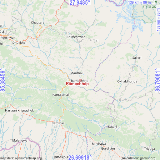
Rāmechhāp GPS coordinates[2]
27° 19' 32.16" North, 86° 5' 15.648" East
| Map corner | latitude | longitude |
|---|---|---|
| Upper-left | 27.9485°, | 85.38456° |
| Center: | 27.3256°, | 86.08768° |
| Lower-right: | 26.69918°, | 86.79081° |
| Map W x H: | 138.9×138.9 km | = 86.3×86.3mi |
| max Lat: | 30.04651° ⇑77% North |
| Rāmechhāp: | 27.3256° |
| min Lat: | ⇓23% South 26.45505° |
| min Long | Rāmechhāp | max Long |
| 80.17715° | 86.08768° | 88.09436° |
| W 78.4%⇐ | ⇒21.6% E |
Elevation
Elevation of Rāmechhāp is 1258 m = 4127 ft, and this is 82.8 m = 272 ft above average elevation for this country.
| Max E: |
5251 m = 17228 ft | 45.9% |
| Rāmechhāp | 1258 m 4127 ft | |
| Avg. | 1175.2 m = 3856 ft | |
Min E: |
72 m = 236 ft | 54.1% |
See also: Nepal elevation on elevation.city.
Geographical zone
Rāmechhāp is located in North temperate zone (between Tropic of Cancer and the Arctic Circle). Distance of this Northern Tropic circle is 432.4 km =268.7 mi to South.| Distance of | km | miles | from Rāmechhāp |
|---|---|---|---|
| North Pole | 6968.7 | 4330.1 | to North |
| Arctic Circle | 4362.9 | 2711 | to North |
| Tropic Cancer | 432.4 | 268.7 | to South |
| Equator | 3038.3 | 1887.9 | to South |


Nearby cities:
15 places around Rāmechhāp: (largest is in red/bold)
• Banepā
65.4 km =40.6 mi,  301°
301°
• Bhaktapur
75.5 km =46.9 mi, 300°
• Chhetrapa1
39.1 km =24.3 mi,  4°
4°
• Dhulikhel
63.1 km =39.2 mi, 301°
• Hari Bdr Tamang House
70.6 km =43.9 mi, 298°
• Janakpur
68.3 km =42.4 mi,  193°
193°
• Kothari
71.8 km =44.6 mi,  349°
349°
• Lahān
77.9 km =48.4 mi,  149°
149°
• Madhyapur Thimi
79.5 km =49.4 mi, 299°
• Malaṅgawā
73.9 km =45.9 mi,  225°
225°
• Nagarkot
70.7 km =43.9 mi,  307°
307°
• Panauti
62.9 km =39.1 mi, 297°
• Panauti̇̄
63.4 km =39.4 mi, 296°
• Siraha
75.6 km =47 mi,  170°
170°
• kankrabari Dovan
70.6 km =43.9 mi, 298°
Sources, notices
• [Note1] Compared only with cities in Nepal existing in our database
• [Src1] Map data: © OpenStreetMap contributors (CC-BY-SA)
• [Src2] Other city data from geonames.org with taken over terms of usage.
• [Src3] Geographical zone / Annual Mean Temperature by Robert A. Rohde @ Wikipedia
