Kothari geodata
Kothari is a populated place; located in Nepal in Asia/Kathmandu (GMT+5.75) time zone. With population of 1,600 people, there are 56 cities with bigger population in this country. Compared to other cities in Nepal, 58.1% of cities are located further ↓South; 77% of cities are located further ←West and 78.4% of cities have lower elevation than Kothari. Note1


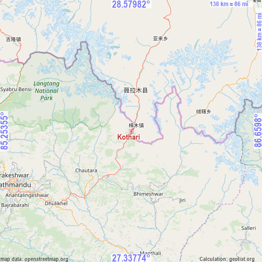
Kothari GPS coordinates[2]
27° 57' 38.052" North, 85° 57' 24.012" East
| Map corner | latitude | longitude |
|---|---|---|
| Upper-left | 28.57982°, | 85.25355° |
| Center: | 27.96057°, | 85.95667° |
| Lower-right: | 27.33774°, | 86.6598° |
| Map W x H: | 138.1×138.1 km | = 85.8×85.8mi |
| max Lat: | 30.04651° ⇑41.9% North |
| Kothari: | 27.96057° |
| min Lat: | ⇓58.1% South 26.45505° |
| min Long | Kothari | max Long |
| 80.17715° | 85.95667° | 88.09436° |
| W 77%⇐ | ⇒23% E |
Elevation
Elevation of Kothari is 1629 m = 5344 ft, and this is 453.8 m = 1489 ft above average elevation for this country.
| Max E: |
5251 m = 17228 ft | 21.6% |
| Kothari | 1629 m 5344 ft | |
| Avg. | 1175.2 m = 3856 ft | |
Min E: |
72 m = 236 ft | 78.4% |
See also: Nepal elevation on elevation.city.
Geographical zone
Kothari is located in North temperate zone (between Tropic of Cancer and the Arctic Circle). Distance of this Northern Tropic circle is 503 km =312.5 mi to South.| Distance of | km | miles | from Kothari |
|---|---|---|---|
| North Pole | 6898.1 | 4286.3 | to North |
| Arctic Circle | 4292.3 | 2667.1 | to North |
| Tropic Cancer | 503 | 312.5 | to South |
| Equator | 3108.9 | 1931.8 | to South |


Nearby cities:
15 places around Kothari: (largest is in red/bold)
• Banepā
56.2 km =34.9 mi,  229°
229°
• Bhaktapur
60.9 km =37.8 mi,  238°
238°
• Chhetrapa1
35.3 km =21.9 mi,  153°
153°
• Dhulikhel
55.4 km =34.4 mi, 227°
• Hari Bdr Tamang House
61.3 km =38.1 mi, 233°
• Kathmandu
68.8 km =42.8 mi,  245°
245°
• Kirtipur
73.8 km =45.9 mi, 244°
• Madhyapur Thimi
64 km =39.8 mi, 240°
• Nagarkot
50.8 km =31.6 mi, 237°
• Namche Bazar
76.1 km =47.3 mi,  103°
103°
• Panauti
59.9 km =37.2 mi, 225°
• Panauti̇̄
60.3 km =37.5 mi, 226°
• Pātan
70.6 km =43.9 mi, 243°
• Rāmechhāp
71.8 km =44.6 mi,  169°
169°
• kankrabari Dovan
61.3 km =38.1 mi, 232°
Sources, notices
• [Note1] Compared only with cities in Nepal existing in our database
• [Src1] Map data: © OpenStreetMap contributors (CC-BY-SA)
• [Src2] Other city data from geonames.org with taken over terms of usage.
• [Src3] Geographical zone / Annual Mean Temperature by Robert A. Rohde @ Wikipedia
