Nagarkot geodata
Nagarkot (Central Region) is a seat of a fourth-order administrative division; located in Nepal in Asia/Kathmandu (GMT+5.75) time zone. With population of 4,000 people, there are 50 cities with bigger population in this country. Compared to other cities in Nepal, 52.7% of cities are located further ↑North; 67.6% of cities are located further ←West and 83.8% of cities have lower elevation than Nagarkot. Note1
Administrative division(s):
- Level 1: Central Region
- Level 2: Bāgmatī Zone
- Level 3: Bhaktapur
- Level 4: Nagarkot


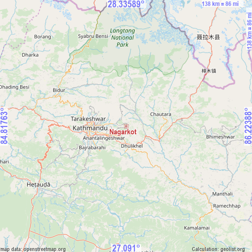
Nagarkot GPS coordinates[2]
27° 42' 54.792" North, 85° 31' 14.7" East
| Map corner | latitude | longitude |
|---|---|---|
| Upper-left | 28.33589°, | 84.81763° |
| Center: | 27.71522°, | 85.52075° |
| Lower-right: | 27.091°, | 86.22388° |
| Map W x H: | 138.4×138.4 km | = 86×86mi |
| max Lat: | 30.04651° ⇑52.7% North |
| Nagarkot: | 27.71522° |
| min Lat: | ⇓47.3% South 26.45505° |
| min Long | Nagarkot | max Long |
| 80.17715° | 85.52075° | 88.09436° |
| W 67.6%⇐ | ⇒32.4% E |
Elevation
Elevation of Nagarkot is 1905 m = 6250 ft, and this is 729.8 m = 2394 ft above average elevation for this country.
| Max E: |
5251 m = 17228 ft | 16.2% |
| Nagarkot | 1905 m 6250 ft | |
| Avg. | 1175.2 m = 3856 ft | |
Min E: |
72 m = 236 ft | 83.8% |
See also: Nepal elevation on elevation.city.
Geographical zone
Nagarkot is located in North temperate zone (between Tropic of Cancer and the Arctic Circle). Distance of this Northern Tropic circle is 475.7 km =295.6 mi to South.| Distance of | km | miles | from Nagarkot |
|---|---|---|---|
| North Pole | 6925.4 | 4303.2 | to North |
| Arctic Circle | 4319.5 | 2684 | to North |
| Tropic Cancer | 475.7 | 295.6 | to South |
| Equator | 3081.6 | 1914.8 | to South |


Nearby cities:
15 places around Nagarkot: (largest is in red/bold)
• Banepā
9.2 km =5.7 mi,  179°
179°
• Bhaktapur
10.1 km =6.3 mi,  242°
242°
• Chhetrapa1
58.8 km =36.5 mi,  94°
94°
• Dhulikhel
10.6 km =6.6 mi,  168°
168°
• Hari Bdr Tamang House
11.4 km =7.1 mi,  212°
212°
• Hetauda
57.8 km =35.9 mi, 236°
• Kathmandu
19.8 km =12.3 mi,  265°
265°
• Kirtipur
24.3 km =15.1 mi,  260°
260°
• Kothari
50.8 km =31.6 mi,  57°
57°
• Madhyapur Thimi
13.7 km =8.5 mi,  253°
253°
• Panauti
14.5 km =9 mi, 179°
• Panauti̇̄
14.5 km =9 mi, 182°
• Pātan
20.8 km =12.9 mi, 258°
• Rāmechhāp
70.7 km =43.9 mi,  127°
127°
• kankrabari Dovan
11.4 km =7.1 mi, 212°
Sources, notices
• [Note1] Compared only with cities in Nepal existing in our database
• [Src1] Map data: © OpenStreetMap contributors (CC-BY-SA)
• [Src2] Other city data from geonames.org with taken over terms of usage.
• [Src3] Geographical zone / Annual Mean Temperature by Robert A. Rohde @ Wikipedia
