Birgañj geodata
Birgañj (Central Region) is a populated place; located in Nepal in Asia/Kathmandu (GMT+5.75) time zone. With population of 133,238 people, there are 4 cities with bigger population in this country. Compared to other cities in Nepal, 79.7% of cities are located further ↑North; 52.7% of cities are located further ←West and 95.9% of cities have higher elevation than Birgañj. Note1


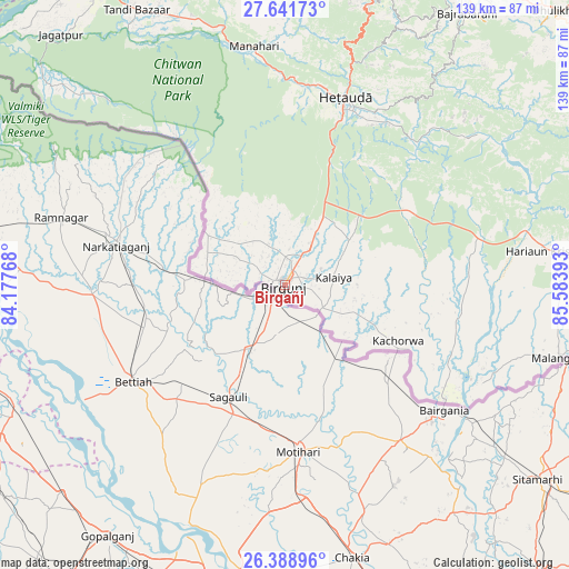
Birgañj GPS coordinates[2]
27° 1' 1.524" North, 84° 52' 50.88" East
| Map corner | latitude | longitude |
|---|---|---|
| Upper-left | 27.64173°, | 84.17768° |
| Center: | 27.01709°, | 84.8808° |
| Lower-right: | 26.38896°, | 85.58393° |
| Map W x H: | 139.3×139.3 km | = 86.6×86.6mi |
| max Lat: | 30.04651° ⇑79.7% North |
| Birgañj: | 27.01709° |
| min Lat: | ⇓20.3% South 26.45505° |
| min Long | Birgañj | max Long |
| 80.17715° | 84.8808° | 88.09436° |
| W 52.7%⇐ | ⇒47.3% E |
Elevation
Elevation of Birgañj is 79 m = 259 ft, and this is 1096.2 m = 3596 ft below average elevation for this country.
| Max E: |
5251 m = 17228 ft | 95.9% |
| Avg. | 1175.2 m = 3856 ft | |
| Birgañj | 79 m = 259 ft | |
Min E: |
72 m = 236 ft | 4.1% |
See also: Birgañj elevation on elevation.city.
Geographical zone
Birgañj is located in North temperate zone (between Tropic of Cancer and the Arctic Circle). Distance of this Northern Tropic circle is 398.1 km =247.4 mi to South.| Distance of | km | miles | from Birgañj |
|---|---|---|---|
| North Pole | 7003 | 4351.5 | to North |
| Arctic Circle | 4397.2 | 2732.3 | to North |
| Tropic Cancer | 398.1 | 247.4 | to South |
| Equator | 3004 | 1866.6 | to South |


Nearby cities:
15 places around Birgañj: (largest is in red/bold)
• Banepā
93.2 km =57.9 mi,  42°
42°
• Bhaktapur
90.9 km =56.5 mi, 36°
• Bharatpur
85.5 km =53.1 mi,  329°
329°
• Dhulikhel
93.8 km =58.3 mi, 44°
• Gaur
48.4 km =30.1 mi,  125°
125°
• Hari Bdr Tamang House
88.8 km =55.2 mi, 40°
• Hetauda
48.1 km =29.9 mi,  18°
18°
• Kathmandu
87.6 km =54.4 mi,  29°
29°
• Kirtipur
83.3 km =51.8 mi, 28°
• Madhyapur Thimi
89.1 km =55.4 mi, 34°
• Malaṅgawā
69.6 km =43.2 mi,  104°
104°
• Panauti
89.4 km =55.6 mi,  45°
45°
• Panauti̇̄
88.9 km =55.2 mi, 44°
• Pātan
84.9 km =52.8 mi, 30°
• kankrabari Dovan
88.8 km =55.2 mi, 40°
Sources, notices
• [Note1] Compared only with cities in Nepal existing in our database
• [Src1] Map data: © OpenStreetMap contributors (CC-BY-SA)
• [Src2] Other city data from geonames.org with taken over terms of usage.
• [Src3] Geographical zone / Annual Mean Temperature by Robert A. Rohde @ Wikipedia
