Bharatpur geodata
Bharatpur (Central Region) is a populated place; located in Nepal in Asia/Kathmandu (GMT+5.75) time zone. With population of 107,157 people, there are 6 cities with bigger population in this country. Compared to other cities in Nepal, 59.5% of cities are located further ↑North; 51.4% of cities are located further ←West and 71.6% of cities have higher elevation than Bharatpur. Note1
Administrative division(s):
- Level 1: Central Region
- Level 2: Nārāyanī Zone
- Level 3: Chitawan
- Level 4: BharatpurN.P.


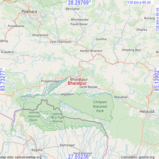
Bharatpur GPS coordinates[2]
27° 40' 36.48" North, 84° 26' 9.204" East
| Map corner | latitude | longitude |
|---|---|---|
| Upper-left | 28.29769°, | 83.73277° |
| Center: | 27.6768°, | 84.43589° |
| Lower-right: | 27.05236°, | 85.13902° |
| Map W x H: | 138.5×138.5 km | = 86.1×86.1mi |
| max Lat: | 30.04651° ⇑59.5% North |
| Bharatpur: | 27.6768° |
| min Lat: | ⇓40.5% South 26.45505° |
| min Long | Bharatpur | max Long |
| 80.17715° | 84.43589° | 88.09436° |
| W 51.4%⇐ | ⇒48.6% E |
Elevation
Elevation of Bharatpur is 212 m = 696 ft, and this is 963.2 m = 3160 ft below average elevation for this country.
| Max E: |
5251 m = 17228 ft | 71.6% |
| Avg. | 1175.2 m = 3856 ft | |
| Bharatpur | 212 m = 696 ft | |
Min E: |
72 m = 236 ft | 28.4% |
See also: Bharatpur elevation on elevation.city.
Geographical zone
Bharatpur is located in North temperate zone (between Tropic of Cancer and the Arctic Circle). Distance of this Northern Tropic circle is 471.5 km =293 mi to South.| Distance of | km | miles | from Bharatpur |
|---|---|---|---|
| North Pole | 6929.7 | 4305.9 | to North |
| Arctic Circle | 4323.8 | 2686.7 | to North |
| Tropic Cancer | 471.5 | 293 | to South |
| Equator | 3077.4 | 1912.2 | to South |


Nearby cities:
15 places around Bharatpur: (largest is in red/bold)
• Bhattarai Danda
54.5 km =33.9 mi,  294°
294°
• Birgañj
85.5 km =53.1 mi,  149°
149°
• Butwāl
97.3 km =60.5 mi,  271°
271°
• Dihi
54.7 km =34 mi, 293°
• Hetauda
64.9 km =40.3 mi,  115°
115°
• Kathmandu
87.1 km =54.1 mi,  88°
88°
• Khudi
67.7 km =42.1 mi,  353°
353°
• Kirtipur
82.9 km =51.5 mi, 89°
• Lamjung
59.7 km =37.1 mi, 353°
• Madhyapur Thimi
93.7 km =58.2 mi, 89°
• Pokhara
80.1 km =49.8 mi,  325°
325°
• Pātan
86.5 km =53.7 mi, 90°
• Sundar Basti
54.6 km =33.9 mi, 294°
• Tānsen
90 km =55.9 mi,  283°
283°
• Wāliṅ
74.8 km =46.5 mi,  297°
297°
Sources, notices
• [Note1] Compared only with cities in Nepal existing in our database
• [Src1] Map data: © OpenStreetMap contributors (CC-BY-SA)
• [Src2] Other city data from geonames.org with taken over terms of usage.
• [Src3] Geographical zone / Annual Mean Temperature by Robert A. Rohde @ Wikipedia
