Sundar Basti geodata
Sundar Basti (Western Region) is a populated place; located in Nepal in Asia/Kathmandu (GMT+5.75) time zone. With population of 900 people, there are 58 cities with bigger population in this country. Compared to other cities in Nepal, 52.7% of cities are located further ↓South; 59.5% of cities are located further →East and 64.9% of cities have higher elevation than Sundar Basti. Note1
Administrative division(s):
- Level 1: Western Region
- Level 2: Gandakī Zone
- Level 3: Syāngjā
- Level 4: Sankhar


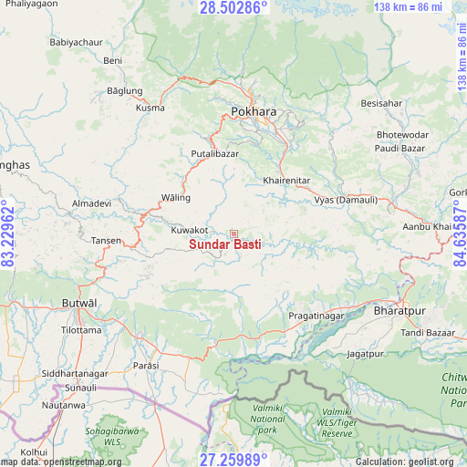
Sundar Basti GPS coordinates[2]
27° 52' 59.376" North, 83° 55' 57.864" East
| Map corner | latitude | longitude |
|---|---|---|
| Upper-left | 28.50286°, | 83.22962° |
| Center: | 27.88316°, | 83.93274° |
| Lower-right: | 27.25989°, | 84.63587° |
| Map W x H: | 138.2×138.2 km | = 85.9×85.9mi |
| max Lat: | 30.04651° ⇑47.3% North |
| Sundar Basti: | 27.88316° |
| min Lat: | ⇓52.7% South 26.45505° |
| min Long | Sundar Basti | max Long |
| 80.17715° | 83.93274° | 88.09436° |
| W 40.5%⇐ | ⇒59.5% E |
Elevation
Elevation of Sundar Basti is 460 m = 1509 ft, and this is 715.2 m = 2346 ft below average elevation for this country.
| Max E: |
5251 m = 17228 ft | 64.9% |
| Avg. | 1175.2 m = 3856 ft | |
| Sundar Basti | 460 m = 1509 ft | |
Min E: |
72 m = 236 ft | 35.1% |
See also: Nepal elevation on elevation.city.
Geographical zone
Sundar Basti is located in North temperate zone (between Tropic of Cancer and the Arctic Circle). Distance of this Northern Tropic circle is 494.4 km =307.2 mi to South.| Distance of | km | miles | from Sundar Basti |
|---|---|---|---|
| North Pole | 6906.7 | 4291.6 | to North |
| Arctic Circle | 4300.9 | 2672.5 | to North |
| Tropic Cancer | 494.4 | 307.2 | to South |
| Equator | 3100.3 | 1926.4 | to South |


Nearby cities:
15 places around Sundar Basti: (largest is in red/bold)
• Bharatpur
54.6 km =33.9 mi,  114°
114°
• Bhattarai Danda
0.1 km =0.1 mi,  71°
71°
• Butwāl
51.8 km =32.2 mi,  246°
246°
• Bāglung
54.8 km =34.1 mi,  322°
322°
• Chame
80.8 km =50.2 mi,  22°
22°
• Chitre
64.9 km =40.3 mi,  338°
338°
• Dihi
1 km =0.6 mi,  210°
210°
• Khudi
61 km =37.9 mi,  43°
43°
• Lamjung
55.8 km =34.7 mi,  49°
49°
• Nawal
86.7 km =53.9 mi,  11°
11°
• Pisang
84 km =52.2 mi, 14°
• Pokhara
42.8 km =26.6 mi,  4°
4°
• Siddharthanagar
63.8 km =39.6 mi,  228°
228°
• Tānsen
38 km =23.6 mi,  267°
267°
• Wāliṅ
20.4 km =12.7 mi,  303°
303°
Sources, notices
• [Note1] Compared only with cities in Nepal existing in our database
• [Src1] Map data: © OpenStreetMap contributors (CC-BY-SA)
• [Src2] Other city data from geonames.org with taken over terms of usage.
• [Src3] Geographical zone / Annual Mean Temperature by Robert A. Rohde @ Wikipedia
