Yape geodata
Yape (Emberá) is a seat of a third-order administrative division; located in Panama in America/Panama (GMT-5) time zone. With population of 170 people, there are 618 cities with bigger population in this country. Compared to other cities in Panama, 77.1% of cities are located further ↑North; 99.1% of cities are located further ←West and 83.8% of cities have higher elevation than Yape. Note1


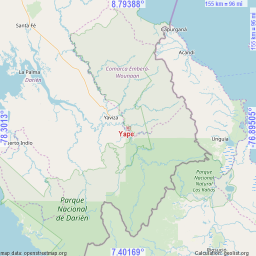
Yape GPS coordinates[2]
8° 5' 54.204" North, 77° 35' 53.412" West
| Map corner | latitude | longitude |
|---|---|---|
| Upper-left | 8.79388°, | -78.3013° |
| Center: | 8.09839°, | -77.59817° |
| Lower-right: | 7.40169°, | -76.89505° |
| Map W x H: | 154.8×154.8 km | = 96.2×96.2mi |
| max Lat: | 9.60898° ⇑77.1% North |
| Yape: | 8.09839° |
| min Lat: | ⇓22.9% South 7.26534° |
| min Long | Yape | max Long |
| -82.91275° | -77.59817° | -77.38965° |
| W 99.1%⇐ | ⇒0.90000000000001% E |
Elevation
Elevation of Yape is 19 m = 62 ft, and this is 153.1 m = 502 ft below average elevation for this country.
| Max E: |
2103 m = 6900 ft | 83.8% |
| Avg. | 172.1 m = 565 ft | |
| Yape | 19 m = 62 ft | |
Min E: |
-1 m = -3 ft | 16.2% |
See also: Panama elevation on elevation.city.
Geographical zone
Yape is located in North Torrid zone (between Equator and Tropic of Cancer). Distance of Equator is 900.5 km =559.5 mi to South.| Distance of | km | miles | from Yape |
|---|---|---|---|
| North Pole | 9106.6 | 5658.6 | to North |
| Arctic Circle | 6500.7 | 4039.3 | to North |
| Tropic Cancer | 1705.5 | 1059.7 | to North |
| Equator | 900.5 | 559.5 | to South |


Nearby cities:
15 places around Yape: (largest is in red/bold)
• Boca de Cupé
7.7 km =4.8 mi,  173°
173°
• Camogantí
32.4 km =20.1 mi,  258°
258°
• Chepigana
54.1 km =33.6 mi,  292°
292°
• Corozal
11.4 km =7.1 mi,  0°
0°
• El Real de Santa María
12.8 km =8 mi, 285°
• Jingurudó
58.1 km =36.1 mi,  245°
245°
• Lajas Blancas
42.3 km =26.3 mi,  326°
326°
• Paya
31.8 km =19.8 mi,  133°
133°
• Pinogana
10.1 km =6.3 mi,  279°
279°
• Pueblo Nuevo
12 km =7.5 mi,  298°
298°
• Púcuro
18 km =11.2 mi,  137°
137°
• Setegantí
59.4 km =36.9 mi, 291°
• Tucutí
42.7 km =26.5 mi,  243°
243°
• Unión Chocó
7.1 km =4.4 mi,  102°
102°
• Yaviza
12.4 km =7.7 mi, 302°
Sources, notices
• [Note1] Compared only with cities in Panama existing in our database
• [Src1] Map data: © OpenStreetMap contributors (CC-BY-SA)
• [Src2] Other city data from geonames.org with taken over terms of usage.
• [Src3] Geographical zone / Annual Mean Temperature by Robert A. Rohde @ Wikipedia
