Paya geodata
Paya (Darién) is a seat of a third-order administrative division; located in Panama in America/Panama (GMT-5) time zone. In our database, there are 694 cities with bigger population. Compared to other cities in Panama, 86.6% of cities are located further ↑North; 100% of cities are located further ←West and 58.2% of cities have lower elevation than Paya. Note1


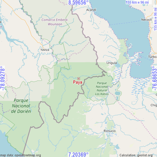
Paya GPS coordinates[2]
7° 54' 2.556" North, 77° 23' 22.74" West
| Map corner | latitude | longitude |
|---|---|---|
| Upper-left | 8.59656°, | -78.09278° |
| Center: | 7.90071°, | -77.38965° |
| Lower-right: | 7.20369°, | -76.68653° |
| Map W x H: | 154.9×154.9 km | = 96.3×96.3mi |
| max Lat: | 9.60898° ⇑86.6% North |
| Paya: | 7.90071° |
| min Lat: | ⇓13.4% South 7.26534° |
| min Long | Paya | max Long |
| -82.91275° | -77.38965° | -77.38965° |
| W 100%⇐ | ⇒0% E |
Elevation
Elevation of Paya is 97 m = 318 ft, and this is 75.1 m = 246 ft below average elevation for this country.
| Max E: |
2103 m = 6900 ft | 41.8% |
| Avg. | 172.1 m = 565 ft | |
| Paya | 97 m = 318 ft | |
Min E: |
-1 m = -3 ft | 58.2% |
See also: Panama elevation on elevation.city.
Geographical zone
Paya is located in North Torrid zone (between Equator and Tropic of Cancer). Distance of Equator is 878.5 km =545.9 mi to South.| Distance of | km | miles | from Paya |
|---|---|---|---|
| North Pole | 9128.6 | 5672.2 | to North |
| Arctic Circle | 6522.7 | 4053 | to North |
| Tropic Cancer | 1727.4 | 1073.4 | to North |
| Equator | 878.5 | 545.9 | to South |


Nearby cities:
15 places around Paya: (largest is in red/bold)
• Armila
85 km =52.8 mi,  355°
355°
• Boca de Cupé
26.3 km =16.3 mi,  303°
303°
• Camogantí
56.9 km =35.4 mi,  285°
285°
• Chepigana
84.6 km =52.6 mi, 300°
• Corozal
40.4 km =25.1 mi,  325°
325°
• El Real de Santa María
43.5 km =27 mi,  305°
305°
• Jingurudó
75.7 km =47 mi,  268°
268°
• Lajas Blancas
73.7 km =45.8 mi,  320°
320°
• Pinogana
40.5 km =25.2 mi, 305°
• Pueblo Nuevo
43.4 km =27 mi, 309°
• Púcuro
13.8 km =8.6 mi, 308°
• Tucutí
61.3 km =38.1 mi, 272°
• Unión Chocó
25.9 km =16.1 mi, 321°
• Yape
31.8 km =19.8 mi, 313°
• Yaviza
44 km =27.3 mi, 310°
Sources, notices
• [Note1] Compared only with cities in Panama existing in our database
• [Src1] Map data: © OpenStreetMap contributors (CC-BY-SA)
• [Src2] Other city data from geonames.org with taken over terms of usage.
• [Src3] Geographical zone / Annual Mean Temperature by Robert A. Rohde @ Wikipedia
