Vaquilla geodata
Vaquilla (Coclé) is a populated place; located in Panama in America/Panama (GMT-5) time zone. With population of 980 people, there are 262 cities with bigger population in this country. Compared to other cities in Panama, 70% of cities are located further ↓South; 67.6% of cities are located further ←West and 80.2% of cities have lower elevation than Vaquilla. Note1


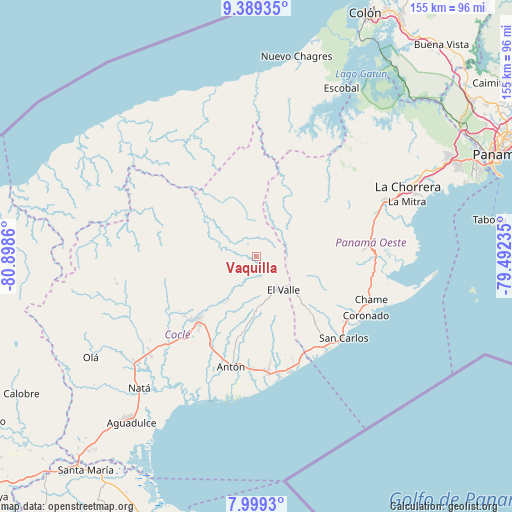
Vaquilla GPS coordinates[2]
8° 41' 41.892" North, 80° 11' 43.692" West
| Map corner | latitude | longitude |
|---|---|---|
| Upper-left | 9.38935°, | -80.8986° |
| Center: | 8.69497°, | -80.19547° |
| Lower-right: | 7.9993°, | -79.49235° |
| Map W x H: | 154.6×154.6 km | = 96.1×96.1mi |
| max Lat: | 9.60898° ⇑30% North |
| Vaquilla: | 8.69497° |
| min Lat: | ⇓70% South 7.26534° |
| min Long | Vaquilla | max Long |
| -82.91275° | -80.19547° | -77.38965° |
| W 67.6%⇐ | ⇒32.4% E |
Elevation
Elevation of Vaquilla is 263 m = 863 ft, and this is 90.9 m = 298 ft above average elevation for this country.
| Max E: |
2103 m = 6900 ft | 19.8% |
| Vaquilla | 263 m 863 ft | |
| Avg. | 172.1 m = 565 ft | |
Min E: |
-1 m = -3 ft | 80.2% |
See also: Panama elevation on elevation.city.
Geographical zone
Vaquilla is located in North Torrid zone (between Equator and Tropic of Cancer). Distance of Equator is 966.8 km =600.7 mi to South.| Distance of | km | miles | from Vaquilla |
|---|---|---|---|
| North Pole | 9040.3 | 5617.4 | to North |
| Arctic Circle | 6434.4 | 3998.1 | to North |
| Tropic Cancer | 1639.1 | 1018.5 | to North |
| Equator | 966.8 | 600.7 | to South |


Nearby cities:
15 places around Vaquilla: (largest is in red/bold)
• Alto de La Estancia
12 km =7.5 mi,  174°
174°
• Caimito
9.4 km =5.8 mi,  210°
210°
• Chiguirí Arriba
2.6 km =1.6 mi, 166°
• Churuquita Grande
14 km =8.7 mi,  216°
216°
• Entradero
14.1 km =8.8 mi,  185°
185°
• Mata Ahogado
14.1 km =8.8 mi,  127°
127°
• Membrillo
12.7 km =7.9 mi, 188°
• Miraflores
11.9 km =7.4 mi,  229°
229°
• Pajonal Abajo
14 km =8.7 mi, 209°
• San Miguel Centro
5.3 km =3.3 mi,  10°
10°
• San Pedro
4.3 km =2.7 mi,  315°
315°
• Sofre
9.1 km =5.7 mi, 194°
• Tambo
11.4 km =7.1 mi,  251°
251°
• Tavidal Arriba
2.6 km =1.6 mi,  122°
122°
• Turega
9.2 km =5.7 mi,  179°
179°
Sources, notices
• [Note1] Compared only with cities in Panama existing in our database
• [Src1] Map data: © OpenStreetMap contributors (CC-BY-SA)
• [Src2] Other city data from geonames.org with taken over terms of usage.
• [Src3] Geographical zone / Annual Mean Temperature by Robert A. Rohde @ Wikipedia
