San Carlitos geodata
San Carlitos (Chiriquí) is a populated place; located in Panama in America/Panama (GMT-5) time zone. With population of 698 people, there are 358 cities with bigger population in this country. Compared to other cities in Panama, 51.9% of cities are located further ↓South; 86.9% of cities are located further →East and 62.6% of cities have lower elevation than San Carlitos. Note1


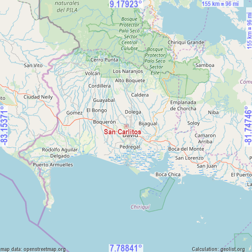
San Carlitos GPS coordinates[2]
8° 29' 4.02" North, 82° 27' 2.088" West
| Map corner | latitude | longitude |
|---|---|---|
| Upper-left | 9.17923°, | -83.15371° |
| Center: | 8.48445°, | -82.45058° |
| Lower-right: | 7.78841°, | -81.74746° |
| Map W x H: | 154.6×154.6 km | = 96.1×96.1mi |
| max Lat: | 9.60898° ⇑48.1% North |
| San Carlitos: | 8.48445° |
| min Lat: | ⇓51.9% South 7.26534° |
| min Long | San Carlitos | max Long |
| -82.91275° | -82.45058° | -77.38965° |
| W 13.1%⇐ | ⇒86.9% E |
Elevation
Elevation of San Carlitos is 117 m = 384 ft, and this is 55.1 m = 181 ft below average elevation for this country.
| Max E: |
2103 m = 6900 ft | 37.4% |
| Avg. | 172.1 m = 565 ft | |
| San Carlitos | 117 m = 384 ft | |
Min E: |
-1 m = -3 ft | 62.6% |
See also: Panama elevation on elevation.city.
Geographical zone
San Carlitos is located in North Torrid zone (between Equator and Tropic of Cancer). Distance of Equator is 943.4 km =586.2 mi to South.| Distance of | km | miles | from San Carlitos |
|---|---|---|---|
| North Pole | 9063.7 | 5631.9 | to North |
| Arctic Circle | 6457.8 | 4012.7 | to North |
| Tropic Cancer | 1662.5 | 1033 | to North |
| Equator | 943.4 | 586.2 | to South |


Nearby cities:
15 places around San Carlitos: (largest is in red/bold)
• Aguacatal
2.7 km =1.7 mi,  191°
191°
• Algarrobos Arriba
4.6 km =2.9 mi,  41°
41°
• Caimito
7.2 km =4.5 mi,  28°
28°
• David
6.7 km =4.2 mi,  161°
161°
• Los Algarrobos
3.2 km =2 mi,  66°
66°
• Los Anastacios
5.9 km =3.7 mi, 30°
• Mata del Nance
6.7 km =4.2 mi,  124°
124°
• Montilla
3.9 km =2.4 mi,  234°
234°
• Nuevo San Carlitos
3.4 km =2.1 mi,  154°
154°
• Portachuelo
3.7 km =2.3 mi,  110°
110°
• Quinteño
6.5 km =4 mi,  103°
103°
• Rincón Largo
6.3 km =3.9 mi,  50°
50°
• San Juan del Tejal
4.5 km =2.8 mi,  274°
274°
• San Pablo Viejo Abajo
6.6 km =4.1 mi,  238°
238°
• San Pablo Viejo Arriba
6 km =3.7 mi, 265°
Sources, notices
• [Note1] Compared only with cities in Panama existing in our database
• [Src1] Map data: © OpenStreetMap contributors (CC-BY-SA)
• [Src2] Other city data from geonames.org with taken over terms of usage.
• [Src3] Geographical zone / Annual Mean Temperature by Robert A. Rohde @ Wikipedia
