Nuevo San Carlitos geodata
Nuevo San Carlitos (Chiriquí) is a populated place; located in Panama in America/Panama (GMT-5) time zone. With population of 1,724 people, there are 138 cities with bigger population in this country. Compared to other cities in Panama, 52.3% of cities are located further ↑North; 86.4% of cities are located further →East and 56.3% of cities have higher elevation than Nuevo San Carlitos. Note1


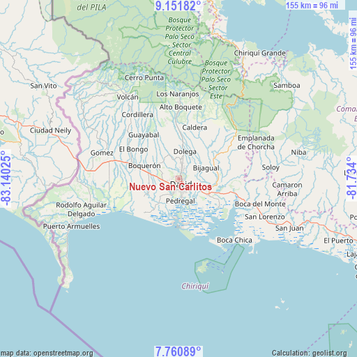
Nuevo San Carlitos GPS coordinates[2]
8° 27' 25.128" North, 82° 26' 13.632" West
| Map corner | latitude | longitude |
|---|---|---|
| Upper-left | 9.15182°, | -83.14025° |
| Center: | 8.45698°, | -82.43712° |
| Lower-right: | 7.76089°, | -81.734° |
| Map W x H: | 154.7×154.7 km | = 96.1×96.1mi |
| max Lat: | 9.60898° ⇑52.3% North |
| Nuevo San Carlitos: | 8.45698° |
| min Lat: | ⇓47.7% South 7.26534° |
| min Long | Nuevo San Carli | max Long |
| -82.91275° | -82.43712° | -77.38965° |
| W 13.6%⇐ | ⇒86.4% E |
Elevation
Elevation of Nuevo San Carlitos is 61 m = 200 ft, and this is 111.1 m = 365 ft below average elevation for this country.
| Max E: |
2103 m = 6900 ft | 56.3% |
| Avg. | 172.1 m = 565 ft | |
| Nuevo San Carlitos | 61 m = 200 ft | |
Min E: |
-1 m = -3 ft | 43.7% |
See also: Panama elevation on elevation.city.
Geographical zone
Nuevo San Carlitos is located in North Torrid zone (between Equator and Tropic of Cancer). Distance of Equator is 940.3 km =584.3 mi to South.| Distance of | km | miles | from Nuevo San Carlitos |
|---|---|---|---|
| North Pole | 9066.7 | 5633.8 | to North |
| Arctic Circle | 6460.8 | 4014.6 | to North |
| Tropic Cancer | 1665.6 | 1035 | to North |
| Equator | 940.3 | 584.3 | to South |


Nearby cities:
15 places around Nuevo San Carlitos: (largest is in red/bold)
• Aguacatal
2.1 km =1.3 mi,  282°
282°
• Algarrobos Arriba
6.7 km =4.2 mi,  13°
13°
• David
3.4 km =2.1 mi,  168°
168°
• Las Lomas
6.3 km =3.9 mi,  119°
119°
• Los Algarrobos
4.6 km =2.9 mi,  18°
18°
• Mata del Nance
4.1 km =2.5 mi,  100°
100°
• Montilla
4.7 km =2.9 mi, 279°
• Portachuelo
2.6 km =1.6 mi,  47°
47°
• Quinteño
5 km =3.1 mi,  71°
71°
• Rincón Largo
7.8 km =4.8 mi,  25°
25°
• San Carlitos
3.4 km =2.1 mi,  334°
334°
• San Juan del Tejal
6.8 km =4.2 mi,  299°
299°
• San Pablo Nuevo Abajo
7.9 km =4.9 mi,  243°
243°
• San Pablo Viejo Abajo
7.1 km =4.4 mi,  266°
266°
• San Pablo Viejo Arriba
7.9 km =4.9 mi,  289°
289°
Sources, notices
• [Note1] Compared only with cities in Panama existing in our database
• [Src1] Map data: © OpenStreetMap contributors (CC-BY-SA)
• [Src2] Other city data from geonames.org with taken over terms of usage.
• [Src3] Geographical zone / Annual Mean Temperature by Robert A. Rohde @ Wikipedia
