Puerto Piña geodata
Puerto Piña (Darién) is a populated place; located in Panama in America/Panama (GMT-5) time zone. With population of 883 people, there are 289 cities with bigger population in this country. Compared to other cities in Panama, 97.4% of cities are located further ↑North; 95.6% of cities are located further ←West and 88.9% of cities have higher elevation than Puerto Piña. Note1


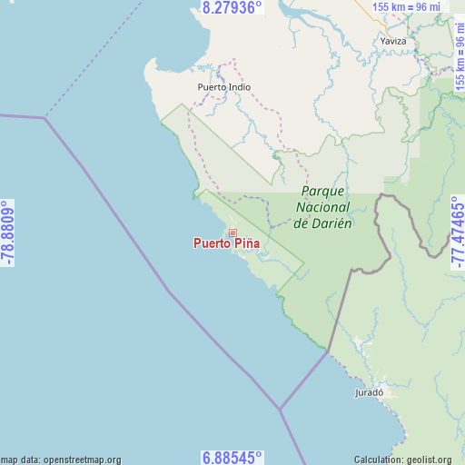
Puerto Piña GPS coordinates[2]
7° 34' 58.692" North, 78° 10' 39.972" West
| Map corner | latitude | longitude |
|---|---|---|
| Upper-left | 8.27936°, | -78.8809° |
| Center: | 7.58297°, | -78.17777° |
| Lower-right: | 6.88545°, | -77.47465° |
| Map W x H: | 155×155 km | = 96.3×96.3mi |
| max Lat: | 9.60898° ⇑97.4% North |
| Puerto Piña: | 7.58297° |
| min Lat: | ⇓2.6% South 7.26534° |
| min Long | Puerto Piña | max Long |
| -82.91275° | -78.17777° | -77.38965° |
| W 95.6%⇐ | ⇒4.4% E |
Elevation
Elevation of Puerto Piña is 13 m = 43 ft, and this is 159.1 m = 522 ft below average elevation for this country.
| Max E: |
2103 m = 6900 ft | 88.9% |
| Avg. | 172.1 m = 565 ft | |
| Puerto Piña | 13 m = 43 ft | |
Min E: |
-1 m = -3 ft | 11.1% |
See also: Panama elevation on elevation.city.
Geographical zone
Puerto Piña is located in North Torrid zone (between Equator and Tropic of Cancer). Distance of Equator is 843.1 km =523.9 mi to South.| Distance of | km | miles | from Puerto Piña |
|---|---|---|---|
| North Pole | 9163.9 | 5694.2 | to North |
| Arctic Circle | 6558 | 4075 | to North |
| Tropic Cancer | 1762.8 | 1095.4 | to North |
| Equator | 843.1 | 523.9 | to South |


Nearby cities:
15 places around Puerto Piña: (largest is in red/bold)
• Bayamón
43 km =26.7 mi,  354°
354°
• Boca de Cupé
81.6 km =50.7 mi,  52°
52°
• Camogantí
60.2 km =37.4 mi,  32°
32°
• Chepigana
79.4 km =49.3 mi,  10°
10°
• El Real de Santa María
79.7 km =49.5 mi,  40°
40°
• Garachiné
57.6 km =35.8 mi,  339°
339°
• Jaqué
7.4 km =4.6 mi,  167°
167°
• Jingurudó
34.8 km =21.6 mi,  18°
18°
• Pinogana
79.9 km =49.6 mi, 42°
• Pueblo Nuevo
63.6 km =39.5 mi, 352°
• Puerto Indio
48.9 km =30.4 mi,  356°
356°
• Punta Alegre
79.6 km =49.5 mi, 353°
• Sambú
49.3 km =30.6 mi, 355°
• Setegantí
79.5 km =49.4 mi, 6°
• Tucutí
46.1 km =28.6 mi, 33°
Sources, notices
• [Note1] Compared only with cities in Panama existing in our database
• [Src1] Map data: © OpenStreetMap contributors (CC-BY-SA)
• [Src2] Other city data from geonames.org with taken over terms of usage.
• [Src3] Geographical zone / Annual Mean Temperature by Robert A. Rohde @ Wikipedia
