Pueblo Nuevo geodata
Pueblo Nuevo (Darién) is a seat of a third-order administrative division; located in Panama in America/Panama (GMT-5) time zone. In our database, there are 694 cities with bigger population. Compared to other cities in Panama, 74.2% of cities are located further ↑North; 94.7% of cities are located further ←West and 92.8% of cities have higher elevation than Pueblo Nuevo. Note1


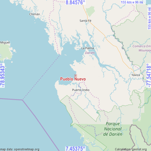
Pueblo Nuevo GPS coordinates[2]
8° 9' 1.296" North, 78° 15' 1.08" West
| Map corner | latitude | longitude |
|---|---|---|
| Upper-left | 8.84576°, | -78.95343° |
| Center: | 8.15036°, | -78.2503° |
| Lower-right: | 7.45375°, | -77.54718° |
| Map W x H: | 154.8×154.8 km | = 96.2×96.2mi |
| max Lat: | 9.60898° ⇑74.2% North |
| Pueblo Nuevo: | 8.15036° |
| min Lat: | ⇓25.8% South 7.26534° |
| min Long | Pueblo Nuevo | max Long |
| -82.91275° | -78.2503° | -77.38965° |
| W 94.7%⇐ | ⇒5.3% E |
Elevation
Elevation of Pueblo Nuevo is 10 m = 33 ft, and this is 162.1 m = 532 ft below average elevation for this country.
| Max E: |
2103 m = 6900 ft | 92.8% |
| Avg. | 172.1 m = 565 ft | |
| Pueblo Nuevo | 10 m = 33 ft | |
Min E: |
-1 m = -3 ft | 7.2% |
See also: Panama elevation on elevation.city.
Geographical zone
Pueblo Nuevo is located in North Torrid zone (between Equator and Tropic of Cancer). Distance of Equator is 906.2 km =563.1 mi to South.| Distance of | km | miles | from Pueblo Nuevo |
|---|---|---|---|
| North Pole | 9100.8 | 5655 | to North |
| Arctic Circle | 6494.9 | 4035.7 | to North |
| Tropic Cancer | 1699.7 | 1056.1 | to North |
| Equator | 906.2 | 563.1 | to South |


Nearby cities:
15 places around Pueblo Nuevo: (largest is in red/bold)
• Barriales
50.5 km =31.4 mi,  342°
342°
• Bayamón
20.6 km =12.8 mi,  169°
169°
• Camogantí
41.8 km =26 mi,  106°
106°
• Chepigana
26.6 km =16.5 mi,  55°
55°
• Cucunatí
47.2 km =29.3 mi,  359°
359°
• Garachiné
15.6 km =9.7 mi,  233°
233°
• Gonzalo Vásquez
37.1 km =23.1 mi,  322°
322°
• Jingurudó
35.6 km =22.1 mi,  147°
147°
• La Palma
30.9 km =19.2 mi,  23°
23°
• Metetí
48.9 km =30.4 mi,  37°
37°
• Puerto Indio
15.1 km =9.4 mi,  160°
160°
• Punta Alegre
16.1 km =10 mi, 358°
• Sambú
14.6 km =9.1 mi, 161°
• Setegantí
23 km =14.3 mi,  45°
45°
• Tucutí
41.7 km =25.9 mi,  126°
126°
Sources, notices
• [Note1] Compared only with cities in Panama existing in our database
• [Src1] Map data: © OpenStreetMap contributors (CC-BY-SA)
• [Src2] Other city data from geonames.org with taken over terms of usage.
• [Src3] Geographical zone / Annual Mean Temperature by Robert A. Rohde @ Wikipedia
