La Espigadilla geodata
La Espigadilla (Los Santos) is a seat of a third-order administrative division; located in Panama in America/Panama (GMT-5) time zone. With population of 1,172 people, there are 208 cities with bigger population in this country. Compared to other cities in Panama, 86.9% of cities are located further ↑North; 58.1% of cities are located further ←West and 63.2% of cities have higher elevation than La Espigadilla. Note1


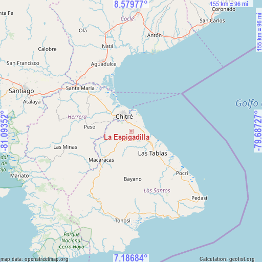
La Espigadilla GPS coordinates[2]
7° 53' 2.004" North, 80° 23' 25.404" West
| Map corner | latitude | longitude |
|---|---|---|
| Upper-left | 8.57977°, | -81.09352° |
| Center: | 7.88389°, | -80.39039° |
| Lower-right: | 7.18684°, | -79.68727° |
| Map W x H: | 154.9×154.9 km | = 96.3×96.3mi |
| max Lat: | 9.60898° ⇑86.9% North |
| La Espigadilla: | 7.88389° |
| min Lat: | ⇓13.1% South 7.26534° |
| min Long | La Espigadilla | max Long |
| -82.91275° | -80.39039° | -77.38965° |
| W 58.1%⇐ | ⇒41.9% E |
Elevation
Elevation of La Espigadilla is 48 m = 157 ft, and this is 124.1 m = 407 ft below average elevation for this country.
| Max E: |
2103 m = 6900 ft | 63.2% |
| Avg. | 172.1 m = 565 ft | |
| La Espigadilla | 48 m = 157 ft | |
Min E: |
-1 m = -3 ft | 36.8% |
See also: Panama elevation on elevation.city.
Geographical zone
La Espigadilla is located in North Torrid zone (between Equator and Tropic of Cancer). Distance of Equator is 876.6 km =544.7 mi to South.| Distance of | km | miles | from La Espigadilla |
|---|---|---|---|
| North Pole | 9130.5 | 5673.4 | to North |
| Arctic Circle | 6524.6 | 4054.2 | to North |
| Tropic Cancer | 1729.3 | 1074.5 | to North |
| Equator | 876.6 | 544.7 | to South |


Nearby cities:
15 places around La Espigadilla: (largest is in red/bold)
• Agua Buena
5.5 km =3.4 mi,  184°
184°
• Chitré
9.6 km =6 mi,  333°
333°
• El Ejido
3.6 km =2.2 mi,  6°
6°
• El Espinal
8.1 km =5 mi,  103°
103°
• El Hato
10.1 km =6.3 mi, 175°
• Guararé Arriba
9.9 km =6.2 mi,  160°
160°
• Las Cruces
8.1 km =5 mi,  212°
212°
• Llano Bonito
10.7 km =6.6 mi,  344°
344°
• Llano Largo
4.6 km =2.9 mi,  302°
302°
• Los Santos
6.2 km =3.9 mi, 332°
• Los Ángeles
3.6 km =2.2 mi,  89°
89°
• Sabana Grande
6.1 km =3.8 mi,  152°
152°
• San Juan Bautista
8.9 km =5.5 mi, 343°
• Santa Ana Arriba
6.2 km =3.9 mi,  28°
28°
• Tres Quebradas
5.2 km =3.2 mi,  201°
201°
Sources, notices
• [Note1] Compared only with cities in Panama existing in our database
• [Src1] Map data: © OpenStreetMap contributors (CC-BY-SA)
• [Src2] Other city data from geonames.org with taken over terms of usage.
• [Src3] Geographical zone / Annual Mean Temperature by Robert A. Rohde @ Wikipedia
