Bella Vista geodata
Bella Vista (Los Santos) is a populated place; located in Panama in America/Panama (GMT-5) time zone. With population of 1,104 people, there are 225 cities with bigger population in this country. Compared to other cities in Panama, 92.1% of cities are located further ↑North; 65.9% of cities are located further ←West and 78.5% of cities have higher elevation than Bella Vista. Note1


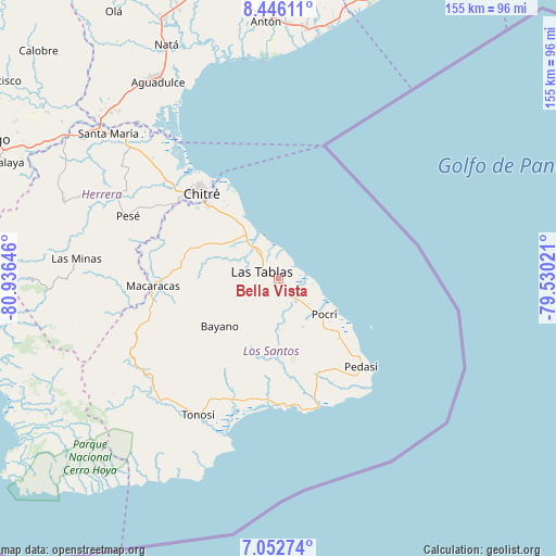
Bella Vista GPS coordinates[2]
7° 45' 0" North, 80° 13' 59.988" West
| Map corner | latitude | longitude |
|---|---|---|
| Upper-left | 8.44611°, | -80.93646° |
| Center: | 7.75°, | -80.23333° |
| Lower-right: | 7.05274°, | -79.53021° |
| Map W x H: | 154.9×154.9 km | = 96.3×96.3mi |
| max Lat: | 9.60898° ⇑92.1% North |
| Bella Vista: | 7.75° |
| min Lat: | ⇓7.9% South 7.26534° |
| min Long | Bella Vista | max Long |
| -82.91275° | -80.23333° | -77.38965° |
| W 65.9%⇐ | ⇒34.1% E |
Elevation
Elevation of Bella Vista is 25 m = 82 ft, and this is 147.1 m = 483 ft below average elevation for this country.
| Max E: |
2103 m = 6900 ft | 78.5% |
| Avg. | 172.1 m = 565 ft | |
| Bella Vista | 25 m = 82 ft | |
Min E: |
-1 m = -3 ft | 21.5% |
See also: Panama elevation on elevation.city.
Geographical zone
Bella Vista is located in North Torrid zone (between Equator and Tropic of Cancer). Distance of Equator is 861.7 km =535.4 mi to South.| Distance of | km | miles | from Bella Vista |
|---|---|---|---|
| North Pole | 9145.3 | 5682.6 | to North |
| Arctic Circle | 6539.5 | 4063.5 | to North |
| Tropic Cancer | 1744.2 | 1083.8 | to North |
| Equator | 861.7 | 535.4 | to South |


Nearby cities:
15 places around Bella Vista: (largest is in red/bold)
• El Carate
7.3 km =4.5 mi,  253°
253°
• El Cocal
5.3 km =3.3 mi, 254°
• El Manantial
3.9 km =2.4 mi,  337°
337°
• Guararé
9.1 km =5.7 mi,  322°
322°
• La Laja
3 km =1.9 mi,  225°
225°
• La Palma
7.9 km =4.9 mi,  149°
149°
• La Pasera
9.4 km =5.8 mi,  304°
304°
• La Tiza
6.5 km =4 mi,  271°
271°
• Las Palmitas
6.8 km =4.2 mi,  284°
284°
• Las Tablas
4.9 km =3 mi,  289°
289°
• Las Tablas Abajo
5.5 km =3.4 mi, 337°
• Peña Blanca
6.5 km =4 mi,  238°
238°
• San José
8.5 km =5.3 mi,  188°
188°
• Santo Domingo
1 km =0.6 mi, 245°
• Sesteadero
2.1 km =1.3 mi, 233°
Sources, notices
• [Note1] Compared only with cities in Panama existing in our database
• [Src1] Map data: © OpenStreetMap contributors (CC-BY-SA)
• [Src2] Other city data from geonames.org with taken over terms of usage.
• [Src3] Geographical zone / Annual Mean Temperature by Robert A. Rohde @ Wikipedia
