Sisa geodata
Sisa (San Martín) is a populated place; located in Peru in America/Lima (GMT-5) time zone. With population of 9,477 people, there are 147 cities with bigger population in this country. Compared to other cities in Peru, 83.4% of cities are located further ↓South; 62.2% of cities are located further →East and 79.6% of cities have higher elevation than Sisa. Note1


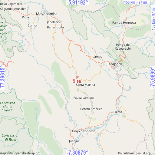
Sisa GPS coordinates[2]
6° 36' 39.06" South, 76° 41' 34.872" West
| Map corner | latitude | longitude |
|---|---|---|
| Upper-left | -5.91192°, | -77.39615° |
| Center: | -6.61085°, | -76.69302° |
| Lower-right: | -7.30879°, | -75.9899° |
| Map W x H: | 155.3×155.3 km | = 96.5×96.5mi |
| max Lat: | -0.96667° ⇑16.6% North |
| Sisa: | -6.61085° |
| min Lat: | ⇓83.4% South -18.01465° |
| min Long | Sisa | max Long |
| -81.30472° | -76.69302° | -69.04167° |
| W 37.8%⇐ | ⇒62.2% E |
Elevation
Elevation of Sisa is 375 m = 1230 ft, and this is 1943.7 m = 6377 ft below average elevation for this country.
| Max E: |
5022 m = 16476 ft | 79.6% |
| Avg. | 2318.7 m = 7607 ft | |
| Sisa | 375 m = 1230 ft | |
Min E: |
1 m = 3 ft | 20.4% |
See also: Peru elevation on elevation.city.
Geographical zone
Sisa is located in South Torrid zone (between Equator and Tropic of Capricorn). Distance of Equator is 735.1 km =456.8 mi to North.| Distance of | km | miles | from Sisa |
|---|---|---|---|
| Equator | 735.1 | 456.8 | to North |
| Tropic Capricorn | 1870.9 | 1162.5 | to South |
| Antarctic Circle | 6666.1 | 4142.1 | to South |
| South Pole | 9272 | 5761.4 | to South |


Nearby cities:
15 places around Sisa: (largest is in red/bold)
• Agua Blanca
12.5 km =7.8 mi,  181°
181°
• Buenos Aires
45.2 km =28.1 mi,  116°
116°
• Cuñumbuqui
26 km =16.2 mi,  64°
64°
• Juan Guerra
40.2 km =25 mi,  85°
85°
• Lamas
27.9 km =17.3 mi,  39°
39°
• Piscoyacu
41.9 km =26 mi,  191°
191°
• Roque
26.3 km =16.3 mi,  333°
333°
• San Pablo
26.5 km =16.5 mi,  150°
150°
• Santa Rosa
11.7 km =7.3 mi,  133°
133°
• Saposoa
37 km =23 mi, 193°
• Shatoja
9.6 km =6 mi,  343°
343°
• Tabalosos
29 km =18 mi,  2°
2°
• Tarapoto
38.2 km =23.7 mi,  71°
71°
• Utcurarca
45.3 km =28.1 mi,  97°
97°
• Zapatero
23.9 km =14.9 mi, 67°
Sources, notices
• [Note1] Compared only with cities in Peru existing in our database
• [Src1] Map data: © OpenStreetMap contributors (CC-BY-SA)
• [Src2] Other city data from geonames.org with taken over terms of usage.
• [Src3] Geographical zone / Annual Mean Temperature by Robert A. Rohde @ Wikipedia
