Shatoja geodata
Shatoja (San Martín) is a seat of a third-order administrative division; located in Peru in America/Lima (GMT-5) time zone. In our database, there are 305 cities with bigger population. Compared to other cities in Peru, 84.4% of cities are located further ↓South; 62.8% of cities are located further →East and 79.1% of cities have higher elevation than Shatoja. Note1


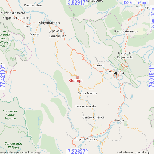
Shatoja GPS coordinates[2]
6° 31' 41.556" South, 76° 43' 5.628" West
| Map corner | latitude | longitude |
|---|---|---|
| Upper-left | -5.82917°, | -77.42136° |
| Center: | -6.52821°, | -76.71823° |
| Lower-right: | -7.22627°, | -76.01511° |
| Map W x H: | 155.3×155.3 km | = 96.5×96.5mi |
| max Lat: | -0.96667° ⇑15.6% North |
| Shatoja: | -6.52821° |
| min Lat: | ⇓84.4% South -18.01465° |
| min Long | Shatoja | max Long |
| -81.30472° | -76.71823° | -69.04167° |
| W 37.2%⇐ | ⇒62.8% E |
Elevation
Elevation of Shatoja is 414 m = 1358 ft, and this is 1904.7 m = 6249 ft below average elevation for this country.
| Max E: |
5022 m = 16476 ft | 79.1% |
| Avg. | 2318.7 m = 7607 ft | |
| Shatoja | 414 m = 1358 ft | |
Min E: |
1 m = 3 ft | 20.9% |
See also: Peru elevation on elevation.city.
Geographical zone
Shatoja is located in South Torrid zone (between Equator and Tropic of Capricorn). Distance of Equator is 725.9 km =451.1 mi to North.| Distance of | km | miles | from Shatoja |
|---|---|---|---|
| Equator | 725.9 | 451.1 | to North |
| Tropic Capricorn | 1880.1 | 1168.2 | to South |
| Antarctic Circle | 6675.3 | 4147.8 | to South |
| South Pole | 9281.2 | 5767.1 | to South |


Nearby cities:
15 places around Shatoja: (largest is in red/bold)
• Agua Blanca
21.8 km =13.5 mi,  173°
173°
• Cuñumbuqui
26.4 km =16.4 mi,  85°
85°
• Juan Guerra
43.3 km =26.9 mi,  98°
98°
• Lamas
23.9 km =14.9 mi,  58°
58°
• Piscoyacu
50.5 km =31.4 mi,  186°
186°
• Roque
16.9 km =10.5 mi,  327°
327°
• San Antonio
44.5 km =27.7 mi,  66°
66°
• San Pablo
36 km =22.4 mi,  154°
154°
• Santa Rosa
20.6 km =12.8 mi, 146°
• Saposoa
45.5 km =28.3 mi, 187°
• Sisa
9.6 km =6 mi,  163°
163°
• Tabalosos
20.2 km =12.6 mi,  11°
11°
• Tarapoto
39.1 km =24.3 mi, 85°
• Utcurarca
50 km =31.1 mi,  107°
107°
• Zapatero
24.9 km =15.5 mi, 90°
Sources, notices
• [Note1] Compared only with cities in Peru existing in our database
• [Src1] Map data: © OpenStreetMap contributors (CC-BY-SA)
• [Src2] Other city data from geonames.org with taken over terms of usage.
• [Src3] Geographical zone / Annual Mean Temperature by Robert A. Rohde @ Wikipedia
