Roque geodata
Roque (San Martín) is a seat of a third-order administrative division; located in Peru in America/Lima (GMT-5) time zone. In our database, there are 305 cities with bigger population. Compared to other cities in Peru, 86.1% of cities are located further ↓South; 64.7% of cities are located further →East and 67.8% of cities have higher elevation than Roque. Note1
Administrative division(s):
- Level 1: San Martín
- Level 2: Provincia de Lamas
- Level 3: Alonso De Alvarado


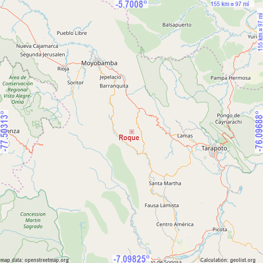
Roque GPS coordinates[2]
6° 24' 0" South, 76° 48' 0" West
| Map corner | latitude | longitude |
|---|---|---|
| Upper-left | -5.7008°, | -77.50313° |
| Center: | -6.4°, | -76.8° |
| Lower-right: | -7.09825°, | -76.09688° |
| Map W x H: | 155.4×155.4 km | = 96.6×96.6mi |
| max Lat: | -0.96667° ⇑13.9% North |
| Roque: | -6.4° |
| min Lat: | ⇓86.1% South -18.01465° |
| min Long | Roque | max Long |
| -81.30472° | -76.8° | -69.04167° |
| W 35.3%⇐ | ⇒64.7% E |
Elevation
Elevation of Roque is 1805 m = 5922 ft, and this is 513.7 m = 1685 ft below average elevation for this country.
| Max E: |
5022 m = 16476 ft | 67.8% |
| Avg. | 2318.7 m = 7607 ft | |
| Roque | 1805 m = 5922 ft | |
Min E: |
1 m = 3 ft | 32.2% |
See also: Peru elevation on elevation.city.
Geographical zone
Roque is located in South Torrid zone (between Equator and Tropic of Capricorn). Distance of Equator is 711.6 km =442.2 mi to North.| Distance of | km | miles | from Roque |
|---|---|---|---|
| Equator | 711.6 | 442.2 | to North |
| Tropic Capricorn | 1894.3 | 1177.1 | to South |
| Antarctic Circle | 6689.6 | 4156.7 | to South |
| South Pole | 9295.4 | 5775.9 | to South |


Nearby cities:
15 places around Roque: (largest is in red/bold)
• Agua Blanca
37.7 km =23.4 mi,  162°
162°
• Cuñumbuqui
37.5 km =23.3 mi,  109°
109°
• Habana
47.8 km =29.7 mi,  317°
317°
• Jepelacio
35.6 km =22.1 mi,  332°
332°
• Lamas
29.5 km =18.3 mi,  93°
93°
• Moyobamba
44.9 km =27.9 mi, 334°
• San Antonio
49.9 km =31 mi, 85°
• Santa Rosa
37.5 km =23.3 mi,  147°
147°
• Shatoja
16.9 km =10.5 mi, 147°
• Sisa
26.3 km =16.3 mi, 153°
• Soritor
44.4 km =27.6 mi,  310°
310°
• Tabalosos
14 km =8.7 mi,  66°
66°
• Tarapoto
49.3 km =30.6 mi,  103°
103°
• Yorongos
47.8 km =29.7 mi, 307°
• Zapatero
36.9 km =22.9 mi, 113°
Sources, notices
• [Note1] Compared only with cities in Peru existing in our database
• [Src1] Map data: © OpenStreetMap contributors (CC-BY-SA)
• [Src2] Other city data from geonames.org with taken over terms of usage.
• [Src3] Geographical zone / Annual Mean Temperature by Robert A. Rohde @ Wikipedia
