Quiruvilca geodata
Quiruvilca (La Libertad) is a populated place; located in Peru in America/Lima (GMT-5) time zone. With population of 9,226 people, there are 150 cities with bigger population in this country. Compared to other cities in Peru, 74.3% of cities are located further ↓South; 83.4% of cities are located further →East and 96.2% of cities have lower elevation than Quiruvilca. Note1
Administrative division(s):
- Level 1: La Libertad
- Level 2: Provincia de Santiago de Chuco
- Level 3: Quiruvilca


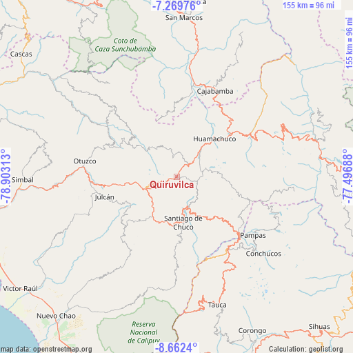
Quiruvilca GPS coordinates[2]
7° 58' 0.012" South, 78° 12' 0" West
| Map corner | latitude | longitude |
|---|---|---|
| Upper-left | -7.26976°, | -78.90313° |
| Center: | -7.96667°, | -78.2° |
| Lower-right: | -8.6624°, | -77.49688° |
| Map W x H: | 154.8×154.9 km | = 96.2×96.3mi |
| max Lat: | -0.96667° ⇑25.7% North |
| Quiruvilca: | -7.96667° |
| min Lat: | ⇓74.3% South -18.01465° |
| min Long | Quiruvilca | max Long |
| -81.30472° | -78.2° | -69.04167° |
| W 16.6%⇐ | ⇒83.4% E |
Elevation
Elevation of Quiruvilca is 4130 m = 13550 ft, and this is 1811.3 m = 5943 ft above average elevation for this country.
| Max E: |
5022 m = 16476 ft | 3.8% |
| Quiruvilca | 4130 m 13550 ft | |
| Avg. | 2318.7 m = 7607 ft | |
Min E: |
1 m = 3 ft | 96.2% |
See also: Peru elevation on elevation.city.
Geographical zone
Quiruvilca is located in South Torrid zone (between Equator and Tropic of Capricorn). Distance of Equator is 885.8 km =550.4 mi to North.| Distance of | km | miles | from Quiruvilca |
|---|---|---|---|
| Equator | 885.8 | 550.4 | to North |
| Tropic Capricorn | 1720.1 | 1068.8 | to South |
| Antarctic Circle | 6515.4 | 4048.5 | to South |
| South Pole | 9121.3 | 5667.7 | to South |


Nearby cities:
15 places around Quiruvilca: (largest is in red/bold)
• Agallpampa
38.6 km =24 mi,  267°
267°
• Angasmarca
23.6 km =14.7 mi,  141°
141°
• Cajabamba
42.3 km =26.3 mi,  23°
23°
• Charat
31.3 km =19.4 mi,  298°
298°
• Chugay
41.9 km =26 mi,  60°
60°
• Curgos
30.7 km =19.1 mi,  67°
67°
• Huamachuco
23.6 km =14.7 mi,  38°
38°
• Huaranchal
41.8 km =26 mi,  318°
318°
• Mache
37.4 km =23.2 mi,  258°
258°
• Marcabal
34.9 km =21.7 mi,  31°
31°
• Mollepata
37.8 km =23.5 mi,  133°
133°
• Pallasca
37.4 km =23.2 mi,  147°
147°
• Pampas
42 km =26.1 mi, 128°
• Santiago de Chuco
19.6 km =12.2 mi,  171°
171°
• Usquil
29.1 km =18.1 mi, 304°
Sources, notices
• [Note1] Compared only with cities in Peru existing in our database
• [Src1] Map data: © OpenStreetMap contributors (CC-BY-SA)
• [Src2] Other city data from geonames.org with taken over terms of usage.
• [Src3] Geographical zone / Annual Mean Temperature by Robert A. Rohde @ Wikipedia
